Fenkeng geodata
Fenkeng (Jiangxi) is a seat of a fourth-order administrative division; located in China in Asia/Shanghai (GMT+8) time zone. In our database, there are 1268 cities with bigger population. Compared to other cities in China, 81.8% of cities are located further ↑North; 57.9% of cities are located further ←West and 52.1% of cities have higher elevation than Fenkeng. Note1


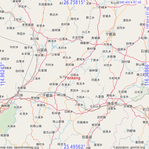
Fenkeng GPS coordinates[2]
26° 7' 42.924" North, 115° 39' 55.98" East
| Map corner | latitude | longitude |
|---|---|---|
| Upper-left | 26.75815°, | 114.96243° |
| Center: | 26.12859°, | 115.66555° |
| Lower-right: | 25.49562°, | 116.36868° |
| Map W x H: | 140.4×140.4 km | = 87.2×87.2mi |
| max Lat: | 53.31946° ⇑81.8% North |
| Fenkeng: | 26.12859° |
| min Lat: | ⇓18.2% South 18.22056° |
| min Long | Fenkeng | max Long |
| 75.07348° | 115.66555° | 134.28917° |
| W 57.9%⇐ | ⇒42.1% E |
Elevation
Elevation of Fenkeng is 149 m = 489 ft, and this is 335.8 m = 1102 ft below average elevation for this country.
| Max E: |
5622 m = 18445 ft | 52.1% |
| Avg. | 484.8 m = 1591 ft | |
| Fenkeng | 149 m = 489 ft | |
Min E: |
-3 m = -10 ft | 47.9% |
See also: China elevation on elevation.city.
Geographical zone
Fenkeng is located in North temperate zone (between Tropic of Cancer and the Arctic Circle). Distance of this Northern Tropic circle is 299.3 km =186 mi to South.| Distance of | km | miles | from Fenkeng |
|---|---|---|---|
| North Pole | 7101.8 | 4412.9 | to North |
| Arctic Circle | 4495.9 | 2793.6 | to North |
| Tropic Cancer | 299.3 | 186 | to South |
| Equator | 2905.2 | 1805.2 | to South |


Nearby cities:
15 places around Fenkeng: (largest is in red/bold)
• Chexi
12.3 km =7.6 mi,  223°
223°
• Dingbei
23.7 km =14.7 mi,  52°
52°
• Gangmian
20.3 km =12.6 mi,  102°
102°
• Gaolong
9.8 km =6.1 mi,  145°
145°
• Ge’ao
16 km =9.9 mi,  21°
21°
• Huanglin
23.8 km =14.8 mi,  190°
190°
• Kuantian
14.5 km =9 mi,  180°
180°
• Lingbei
21.6 km =13.4 mi,  246°
246°
• Ma’an
14.8 km =9.2 mi,  307°
307°
• Ruilin
18.1 km =11.2 mi,  76°
76°
• Shaxin
18.1 km =11.2 mi, 146°
• Wantian
21.5 km =13.4 mi,  165°
165°
• Xianxia
10.4 km =6.5 mi,  260°
260°
• Yinkeng
10.9 km =6.8 mi,  332°
332°
• Zishan
22.5 km =14 mi,  213°
213°
Sources, notices
• [Note1] Compared only with cities in China existing in our database
• [Src1] Map data: © OpenStreetMap contributors (CC-BY-SA)
• [Src2] Other city data from geonames.org with taken over terms of usage.
• [Src3] Geographical zone / Annual Mean Temperature by Robert A. Rohde @ Wikipedia
