Huanglin geodata
Huanglin (Jiangxi) is a seat of a fourth-order administrative division; located in China in Asia/Shanghai (GMT+8) time zone. In our database, there are 1268 cities with bigger population. Compared to other cities in China, 82.7% of cities are located further ↑North; 57.7% of cities are located further ←West and 50.9% of cities have higher elevation than Huanglin. Note1


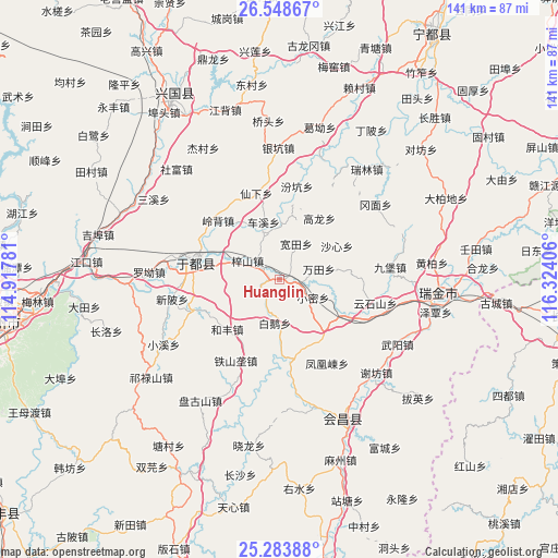
Huanglin GPS coordinates[2]
25° 55' 4.692" North, 115° 37' 15.348" East
| Map corner | latitude | longitude |
|---|---|---|
| Upper-left | 26.54867°, | 114.91781° |
| Center: | 25.91797°, | 115.62093° |
| Lower-right: | 25.28388°, | 116.32406° |
| Map W x H: | 140.6×140.6 km | = 87.4×87.4mi |
| max Lat: | 53.31946° ⇑82.7% North |
| Huanglin: | 25.91797° |
| min Lat: | ⇓17.3% South 18.22056° |
| min Long | Huanglin | max Long |
| 75.07348° | 115.62093° | 134.28917° |
| W 57.7%⇐ | ⇒42.3% E |
Elevation
Elevation of Huanglin is 157 m = 515 ft, and this is 327.8 m = 1075 ft below average elevation for this country.
| Max E: |
5622 m = 18445 ft | 50.9% |
| Avg. | 484.8 m = 1591 ft | |
| Huanglin | 157 m = 515 ft | |
Min E: |
-3 m = -10 ft | 49.1% |
See also: China elevation on elevation.city.
Geographical zone
Huanglin is located in North temperate zone (between Tropic of Cancer and the Arctic Circle). Distance of this Northern Tropic circle is 275.9 km =171.4 mi to South.| Distance of | km | miles | from Huanglin |
|---|---|---|---|
| North Pole | 7125.3 | 4427.5 | to North |
| Arctic Circle | 4519.4 | 2808.2 | to North |
| Tropic Cancer | 275.9 | 171.4 | to South |
| Equator | 2881.8 | 1790.7 | to South |


Nearby cities:
15 places around Huanglin: (largest is in red/bold)
• Bai’e
11.1 km =6.9 mi,  185°
185°
• Chexi
15 km =9.3 mi,  344°
344°
• Gaolong
18.4 km =11.4 mi,  33°
33°
• Gongjiang
21.5 km =13.4 mi,  281°
281°
• Hefeng
18.6 km =11.6 mi,  225°
225°
• Kuantian
9.9 km =6.2 mi, 25°
• Lingbei
21.4 km =13.3 mi,  313°
313°
• Shaxin
16.8 km =10.4 mi,  60°
60°
• Tieshanlong
23.3 km =14.5 mi,  208°
208°
• Wantian
10.3 km =6.4 mi,  75°
75°
• Xianxia
22.5 km =14 mi,  345°
345°
• Xiaomi
9.7 km =6 mi,  118°
118°
• Xijiang
18.3 km =11.4 mi, 119°
• Zhuangkou
20.2 km =12.6 mi,  170°
170°
• Zishan
9.2 km =5.7 mi,  300°
300°
Sources, notices
• [Note1] Compared only with cities in China existing in our database
• [Src1] Map data: © OpenStreetMap contributors (CC-BY-SA)
• [Src2] Other city data from geonames.org with taken over terms of usage.
• [Src3] Geographical zone / Annual Mean Temperature by Robert A. Rohde @ Wikipedia
