Lianran geodata
Lianran (Yunnan) is a seat of a third-order administrative division; located in China in Asia/Shanghai (GMT+8) time zone. With population of 106,795 people, there are 410 cities with bigger population in this country. Compared to other cities in China, 86.7% of cities are located further ↑North; 92.3% of cities are located further →East and 93.8% of cities have lower elevation than Lianran. Note1


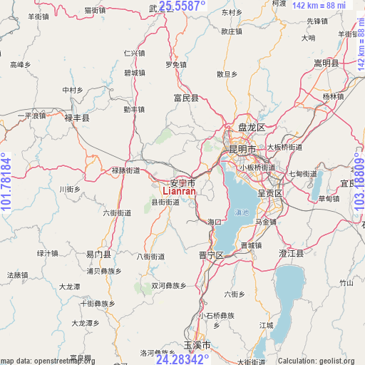
Lianran GPS coordinates[2]
24° 55' 21.756" North, 102° 29' 5.856" East
| Map corner | latitude | longitude |
|---|---|---|
| Upper-left | 25.5587°, | 101.78184° |
| Center: | 24.92271°, | 102.48496° |
| Lower-right: | 24.28342°, | 103.18809° |
| Map W x H: | 141.8×141.8 km | = 88.1×88.1mi |
| max Lat: | 53.31946° ⇑86.7% North |
| Lianran: | 24.92271° |
| min Lat: | ⇓13.3% South 18.22056° |
| min Long | Lianran | max Long |
| 75.07348° | 102.48496° | 134.28917° |
| W 7.7%⇐ | ⇒92.3% E |
Elevation
Elevation of Lianran is 1836 m = 6024 ft, and this is 1351.2 m = 4433 ft above average elevation for this country.
| Max E: |
5622 m = 18445 ft | 6.2% |
| Lianran | 1836 m 6024 ft | |
| Avg. | 484.8 m = 1591 ft | |
Min E: |
-3 m = -10 ft | 93.8% |
See also: Lianran elevation on elevation.city.
Geographical zone
Lianran is located in North temperate zone (between Tropic of Cancer and the Arctic Circle). Distance of this Northern Tropic circle is 165.2 km =102.7 mi to South.| Distance of | km | miles | from Lianran |
|---|---|---|---|
| North Pole | 7235.9 | 4496.2 | to North |
| Arctic Circle | 4630 | 2876.9 | to North |
| Tropic Cancer | 165.2 | 102.7 | to South |
| Equator | 2771.1 | 1721.9 | to South |


Nearby cities:
15 places around Lianran: (largest is in red/bold)
• Caopujie
10.6 km =6.6 mi,  277°
277°
• Gaoyao
15.5 km =9.6 mi,  63°
63°
• Haikou
18.3 km =11.4 mi,  150°
150°
• Huichang
23.1 km =14.4 mi, 151°
• Kunming
26.8 km =16.7 mi, 61°
• Kunyang
30.4 km =18.9 mi,  159°
159°
• Liujia
23.7 km =14.7 mi,  78°
78°
• Liujie
28.2 km =17.5 mi,  246°
246°
• Lubiaojie
22.6 km =14 mi,  285°
285°
• Majie
19.6 km =12.2 mi,  51°
51°
• Mingyihe
16.1 km =10 mi,  200°
200°
• Taiping
10.9 km =6.8 mi,  72°
72°
• Tuguan
28.8 km =17.9 mi, 275°
• Xianjie
9.6 km =6 mi,  221°
221°
• Xiaobanqiao
29.8 km =18.5 mi, 77°
Sources, notices
• [Note1] Compared only with cities in China existing in our database
• [Src1] Map data: © OpenStreetMap contributors (CC-BY-SA)
• [Src2] Other city data from geonames.org with taken over terms of usage.
• [Src3] Geographical zone / Annual Mean Temperature by Robert A. Rohde @ Wikipedia
