Caopujie geodata
Caopujie (Yunnan) is a seat of a fourth-order administrative division; located in China in Asia/Shanghai (GMT+8) time zone. In our database, there are 1268 cities with bigger population. Compared to other cities in China, 86.7% of cities are located further ↑North; 92.5% of cities are located further →East and 94.3% of cities have lower elevation than Caopujie. Note1


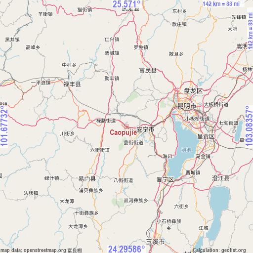
Caopujie GPS coordinates[2]
24° 56' 6.288" North, 102° 22' 49.584" East
| Map corner | latitude | longitude |
|---|---|---|
| Upper-left | 25.571°, | 101.67732° |
| Center: | 24.93508°, | 102.38044° |
| Lower-right: | 24.29586°, | 103.08357° |
| Map W x H: | 141.8×141.8 km | = 88.1×88.1mi |
| max Lat: | 53.31946° ⇑86.7% North |
| Caopujie: | 24.93508° |
| min Lat: | ⇓13.3% South 18.22056° |
| min Long | Caopujie | max Long |
| 75.07348° | 102.38044° | 134.28917° |
| W 7.5%⇐ | ⇒92.5% E |
Elevation
Elevation of Caopujie is 1907 m = 6257 ft, and this is 1422.2 m = 4666 ft above average elevation for this country.
| Max E: |
5622 m = 18445 ft | 5.7% |
| Caopujie | 1907 m 6257 ft | |
| Avg. | 484.8 m = 1591 ft | |
Min E: |
-3 m = -10 ft | 94.3% |
See also: China elevation on elevation.city.
Geographical zone
Caopujie is located in North temperate zone (between Tropic of Cancer and the Arctic Circle). Distance of this Northern Tropic circle is 166.6 km =103.5 mi to South.| Distance of | km | miles | from Caopujie |
|---|---|---|---|
| North Pole | 7234.5 | 4495.3 | to North |
| Arctic Circle | 4628.7 | 2876.1 | to North |
| Tropic Cancer | 166.6 | 103.5 | to South |
| Equator | 2772.5 | 1722.8 | to South |


Nearby cities:
15 places around Caopujie: (largest is in red/bold)
• Bajie
29.6 km =18.4 mi,  183°
183°
• Gaoyao
25 km =15.5 mi,  76°
76°
• Haikou
26.2 km =16.3 mi,  131°
131°
• Huichang
30.6 km =19 mi, 134°
• Lianran
10.6 km =6.6 mi,  97°
97°
• Liujia
34 km =21.1 mi, 84°
• Liujie
19.9 km =12.4 mi,  230°
230°
• Lubiaojie
12.1 km =7.5 mi,  291°
291°
• Majie
28.1 km =17.5 mi,  67°
67°
• Mingyihe
17.1 km =10.6 mi,  163°
163°
• Taiping
21 km =13 mi, 84°
• Tuguan
18.2 km =11.3 mi,  273°
273°
• Xianjie
9.6 km =6 mi,  153°
153°
• Xiaojie
26 km =16.2 mi,  252°
252°
• Yongding
30.4 km =18.9 mi,  15°
15°
Sources, notices
• [Note1] Compared only with cities in China existing in our database
• [Src1] Map data: © OpenStreetMap contributors (CC-BY-SA)
• [Src2] Other city data from geonames.org with taken over terms of usage.
• [Src3] Geographical zone / Annual Mean Temperature by Robert A. Rohde @ Wikipedia
