Kunyang geodata
Kunyang (Yunnan) is a seat of a third-order administrative division; located in China in Asia/Shanghai (GMT+8) time zone. In our database, there are 1268 cities with bigger population. Compared to other cities in China, 87.8% of cities are located further ↑North; 92.2% of cities are located further →East and 94.2% of cities have lower elevation than Kunyang. Note1


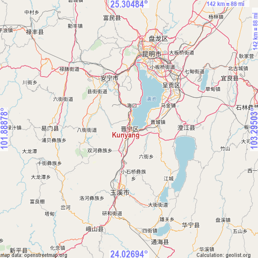
Kunyang GPS coordinates[2]
24° 40' 3.108" North, 102° 35' 30.84" East
| Map corner | latitude | longitude |
|---|---|---|
| Upper-left | 25.30484°, | 101.88878° |
| Center: | 24.66753°, | 102.5919° |
| Lower-right: | 24.02694°, | 103.29503° |
| Map W x H: | 142.1×142.1 km | = 88.3×88.3mi |
| max Lat: | 53.31946° ⇑87.8% North |
| Kunyang: | 24.66753° |
| min Lat: | ⇓12.2% South 18.22056° |
| min Long | Kunyang | max Long |
| 75.07348° | 102.5919° | 134.28917° |
| W 7.8%⇐ | ⇒92.2% E |
Elevation
Elevation of Kunyang is 1896 m = 6220 ft, and this is 1411.2 m = 4630 ft above average elevation for this country.
| Max E: |
5622 m = 18445 ft | 5.8% |
| Kunyang | 1896 m 6220 ft | |
| Avg. | 484.8 m = 1591 ft | |
Min E: |
-3 m = -10 ft | 94.2% |
See also: China elevation on elevation.city.
Geographical zone
Kunyang is located in North temperate zone (between Tropic of Cancer and the Arctic Circle). Distance of this Northern Tropic circle is 136.9 km =85.1 mi to South.| Distance of | km | miles | from Kunyang |
|---|---|---|---|
| North Pole | 7264.3 | 4513.8 | to North |
| Arctic Circle | 4658.4 | 2894.6 | to North |
| Tropic Cancer | 136.9 | 85.1 | to South |
| Equator | 2742.8 | 1704.3 | to South |


Nearby cities:
15 places around Kunyang: (largest is in red/bold)
• Bajie
23.3 km =14.5 mi,  270°
270°
• Beicheng
27.1 km =16.8 mi,  189°
189°
• Haikou
12.6 km =7.8 mi,  352°
352°
• Huacheng
25.5 km =15.8 mi,  58°
58°
• Huayue
17 km =10.6 mi,  107°
107°
• Huichang
8.1 km =5 mi,  2°
2°
• Jincheng
15.9 km =9.9 mi,  75°
75°
• Laojiangjunjie
12.2 km =7.6 mi, 83°
• Liujie
17.4 km =10.8 mi,  146°
146°
• Mingyihe
21.3 km =13.2 mi,  308°
308°
• Shangfang Xinjie
13.2 km =8.2 mi,  197°
197°
• Shuanghejie
19.3 km =12 mi,  234°
234°
• Taipingguan
27 km =16.8 mi,  48°
48°
• Xiaoshiqiao
24.7 km =15.3 mi,  173°
173°
• Xinjie
15.6 km =9.7 mi, 56°
In other languages:
- In Chinese: Chiu-k’un-yang-hsien-ch’eng, Chiu-k’un-yang, K’un-yang-hsien, 昆阳, 昆阳镇, 晋宁县
Sources, notices
• [Note1] Compared only with cities in China existing in our database
• [Src1] Map data: © OpenStreetMap contributors (CC-BY-SA)
• [Src2] Other city data from geonames.org with taken over terms of usage.
• [Src3] Geographical zone / Annual Mean Temperature by Robert A. Rohde @ Wikipedia
