Laiyang geodata
Laiyang (Shandong) is a populated place; located in China in Asia/Shanghai (GMT+8) time zone. With population of 169,594 people, there are 263 cities with bigger population in this country. Compared to other cities in China, 79.1% of cities are located further ↓South; 86.3% of cities are located further ←West and 73.7% of cities have higher elevation than Laiyang. Note1


Laiyang GPS coordinates[2]
36° 58' 32.988" North, 120° 42' 48.996" East
| Map corner | latitude | longitude |
|---|---|---|
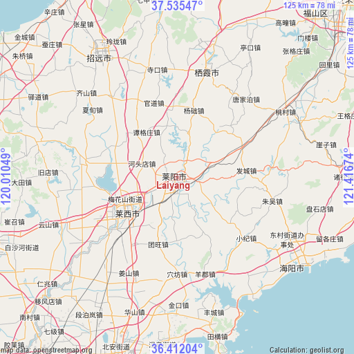
| Upper-left | 37.53547°, | 120.01049° |
| Center: | 36.97583°, | 120.71361° |
| Lower-right: | 36.41204°, | 121.41674° |
| Map W x H: | 124.9×124.9 km | = 77.6×77.6mi |
| max Lat: | 53.31946° ⇑20.9% North |
| Laiyang: | 36.97583° |
| min Lat: | ⇓79.1% South 18.22056° |
| min Long | Laiyang | max Long |
| 75.07348° | 120.71361° | 134.28917° |
| W 86.3%⇐ | ⇒13.7% E |
Elevation
Elevation of Laiyang is 40 m = 131 ft, and this is 444.8 m = 1459 ft below average elevation for this country.
| Max E: |
5622 m = 18445 ft | 73.7% |
| Avg. | 484.8 m = 1591 ft | |
| Laiyang | 40 m = 131 ft | |
Min E: |
-3 m = -10 ft | 26.3% |
See also: Laiyang elevation on elevation.city.
Geographical zone
Laiyang is located in North temperate zone (between Tropic of Cancer and the Arctic Circle). Distance of this Northern Tropic circle is 1505.4 km =935.4 mi to South.| Distance of | km | miles | from Laiyang |
|---|---|---|---|
| North Pole | 5895.7 | 3663.4 | to North |
| Arctic Circle | 3289.8 | 2044.2 | to North |
| Tropic Cancer | 1505.4 | 935.4 | to South |
| Equator | 4111.3 | 2554.6 | to South |


Nearby cities:
15 places around Laiyang: (largest is in red/bold)
• Biguo
30.6 km =19 mi,  332°
332°
• Guandao
27.4 km =17 mi,  342°
342°
• Guanli
23.3 km =14.5 mi,  355°
355°
• Hetoudian
13.3 km =8.3 mi,  290°
290°
• Laixi
21.1 km =13.1 mi,  231°
231°
• Malianzhuang
24.9 km =15.5 mi,  296°
296°
• Muyudian
7 km =4.3 mi,  30°
30°
• Nanshu
33.8 km =21 mi,  278°
278°
• Shanqiandian
14.4 km =8.9 mi,  73°
73°
• Shewopo
22 km =13.7 mi,  36°
36°
• Tangezhuang
19.2 km =11.9 mi, 325°
• Tangjiapo
36.7 km =22.8 mi, 41°
• Xicheng
37.8 km =23.5 mi,  5°
5°
• Xujiadian
26.8 km =16.7 mi,  64°
64°
• Yangchu
24.6 km =15.3 mi, 13°
Sources, notices
• [Note1] Compared only with cities in China existing in our database
• [Src1] Map data: © OpenStreetMap contributors (CC-BY-SA)
• [Src2] Other city data from geonames.org with taken over terms of usage.
• [Src3] Geographical zone / Annual Mean Temperature by Robert A. Rohde @ Wikipedia
