Jinji geodata
Jinji (Guangxi) is a populated place; located in China in Asia/Shanghai (GMT+8) time zone. With population of 56,816 people, there are 772 cities with bigger population in this country. Compared to other cities in China, 93.3% of cities are located further ↑North; 67.8% of cities are located further →East and 73% of cities have higher elevation than Jinji. Note1


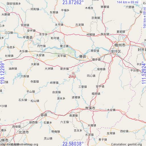
Jinji GPS coordinates[2]
23° 13' 41.016" North, 110° 49' 33.996" East
| Map corner | latitude | longitude |
|---|---|---|
| Upper-left | 23.87262°, | 110.12299° |
| Center: | 23.22806°, | 110.82611° |
| Lower-right: | 22.58038°, | 111.52924° |
| Map W x H: | 143.7×143.7 km | = 89.3×89.3mi |
| max Lat: | 53.31946° ⇑93.3% North |
| Jinji: | 23.22806° |
| min Lat: | ⇓6.7% South 18.22056° |
| min Long | Jinji | max Long |
| 75.07348° | 110.82611° | 134.28917° |
| W 32.2%⇐ | ⇒67.8% E |
Elevation
Elevation of Jinji is 42 m = 138 ft, and this is 442.8 m = 1453 ft below average elevation for this country.
| Max E: |
5622 m = 18445 ft | 73% |
| Avg. | 484.8 m = 1591 ft | |
| Jinji | 42 m = 138 ft | |
Min E: |
-3 m = -10 ft | 27% |
See also: Jinji elevation on elevation.city.
Geographical zone
Jinji is located in North Torrid zone (between Equator and Tropic of Cancer). Distance of this Northern Tropic circle is 23.2 km =14.4 mi to North.| Distance of | km | miles | from Jinji |
|---|---|---|---|
| North Pole | 7424.3 | 4613.2 | to North |
| Arctic Circle | 4818.5 | 2994.1 | to North |
| Tropic Cancer | 23.2 | 14.4 | to North |
| Equator | 2582.7 | 1604.8 | to South |


Nearby cities:
15 places around Jinji: (largest is in red/bold)
• Ducheng
71.8 km =44.6 mi,  88°
88°
• Guixu
65.3 km =40.6 mi,  97°
97°
• Guizi
72.1 km =44.8 mi,  155°
155°
• Jiangchuan
68.8 km =42.8 mi,  73°
73°
• Jiayi
66.8 km =41.5 mi,  150°
150°
• Longwan
70.4 km =43.7 mi, 148°
• Longxu
46.6 km =29 mi,  63°
63°
• Nandu
41.8 km =26 mi,  180°
180°
• Pingfeng
66.2 km =41.1 mi,  82°
82°
• Pingnan
56.6 km =35.2 mi,  308°
308°
• Pingtai
60.3 km =37.5 mi, 87°
• Rongcheng
50.1 km =31.1 mi,  214°
214°
• Tengzhou
19 km =11.8 mi,  20°
20°
• Tongmen
70.5 km =43.8 mi,  111°
111°
• Wuzhou
57.6 km =35.8 mi, 60°
Sources, notices
• [Note1] Compared only with cities in China existing in our database
• [Src1] Map data: © OpenStreetMap contributors (CC-BY-SA)
• [Src2] Other city data from geonames.org with taken over terms of usage.
• [Src3] Geographical zone / Annual Mean Temperature by Robert A. Rohde @ Wikipedia
