Jingyang geodata
Jingyang (Shaanxi) is a seat of a third-order administrative division; located in China in Asia/Shanghai (GMT+8) time zone. In our database, there are 1268 cities with bigger population. Compared to other cities in China, 64% of cities are located further ↓South; 81% of cities are located further →East and 84.7% of cities have lower elevation than Jingyang. Note1


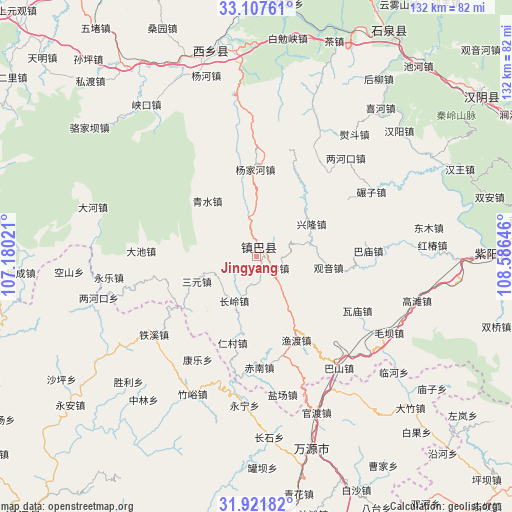
Jingyang GPS coordinates[2]
32° 31' 0.012" North, 107° 52' 59.988" East
| Map corner | latitude | longitude |
|---|---|---|
| Upper-left | 33.10761°, | 107.18021° |
| Center: | 32.51667°, | 107.88333° |
| Lower-right: | 31.92182°, | 108.58646° |
| Map W x H: | 131.8×131.8 km | = 81.9×81.9mi |
| max Lat: | 53.31946° ⇑36% North |
| Jingyang: | 32.51667° |
| min Lat: | ⇓64% South 18.22056° |
| min Long | Jingyang | max Long |
| 75.07348° | 107.88333° | 134.28917° |
| W 19%⇐ | ⇒81% E |
Elevation
Elevation of Jingyang is 963 m = 3159 ft, and this is 478.2 m = 1569 ft above average elevation for this country.
| Max E: |
5622 m = 18445 ft | 15.3% |
| Jingyang | 963 m 3159 ft | |
| Avg. | 484.8 m = 1591 ft | |
Min E: |
-3 m = -10 ft | 84.7% |
See also: China elevation on elevation.city.
Geographical zone
Jingyang is located in North temperate zone (between Tropic of Cancer and the Arctic Circle). Distance of this Northern Tropic circle is 1009.6 km =627.3 mi to South.| Distance of | km | miles | from Jingyang |
|---|---|---|---|
| North Pole | 6391.5 | 3971.5 | to North |
| Arctic Circle | 3785.7 | 2352.3 | to North |
| Tropic Cancer | 1009.6 | 627.3 | to South |
| Equator | 3615.5 | 2246.6 | to South |


Nearby cities:
15 places around Jingyang: (largest is in red/bold)
• Bashan
71 km =44.1 mi,  129°
129°
• Gaonan
73.1 km =45.4 mi, 125°
• Guanba
87.1 km =54.1 mi,  275°
275°
• Guanlu
87.6 km =54.4 mi,  256°
256°
• Hanyin Chengguanzhen
71.5 km =44.4 mi,  54°
54°
• Miaoba
87.9 km =54.6 mi,  137°
137°
• Nuojiang
90 km =55.9 mi,  222°
222°
• Pingba
82.9 km =51.5 mi, 134°
• Shuanghe
77.4 km =48.1 mi,  145°
145°
• Xiangshui
88.8 km =55.2 mi,  302°
302°
• Xingma
90.7 km =56.4 mi,  250°
250°
• Xixiang
53.5 km =33.2 mi,  347°
347°
• Yanhe
70.1 km =43.6 mi, 136°
• Ziyang Chengguanzhen
60.8 km =37.8 mi,  89°
89°
• Zuolan
67.3 km =41.8 mi, 127°
Sources, notices
• [Note1] Compared only with cities in China existing in our database
• [Src1] Map data: © OpenStreetMap contributors (CC-BY-SA)
• [Src2] Other city data from geonames.org with taken over terms of usage.
• [Src3] Geographical zone / Annual Mean Temperature by Robert A. Rohde @ Wikipedia
