Huantuo geodata
Huantuo (Tianjin) is a populated place; located in China in Asia/Shanghai (GMT+8) time zone. With population of 6,561 people, there are 843 cities with bigger population in this country. Compared to other cities in China, 83.8% of cities are located further ↓South; 67.9% of cities are located further ←West and 98.3% of cities have higher elevation than Huantuo. Note1


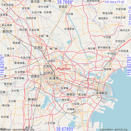
Huantuo GPS coordinates[2]
39° 13' 34.824" North, 117° 19' 26.04" East
| Map corner | latitude | longitude |
|---|---|---|
| Upper-left | 39.7689°, | 116.62078° |
| Center: | 39.22634°, | 117.3239° |
| Lower-right: | 38.67955°, | 118.02703° |
| Map W x H: | 121.1×121.1 km | = 75.2×75.2mi |
| max Lat: | 53.31946° ⇑16.2% North |
| Huantuo: | 39.22634° |
| min Lat: | ⇓83.8% South 18.22056° |
| min Long | Huantuo | max Long |
| 75.07348° | 117.3239° | 134.28917° |
| W 67.9%⇐ | ⇒32.1% E |
Elevation
Elevation of Huantuo is 4 m = 13 ft, and this is 480.8 m = 1577 ft below average elevation for this country.
| Max E: |
5622 m = 18445 ft | 98.3% |
| Avg. | 484.8 m = 1591 ft | |
| Huantuo | 4 m = 13 ft | |
Min E: |
-3 m = -10 ft | 1.7% |
See also: China elevation on elevation.city.
Geographical zone
Huantuo is located in North temperate zone (between Tropic of Cancer and the Arctic Circle). Distance of this Northern Tropic circle is 1755.6 km =1090.9 mi to South.| Distance of | km | miles | from Huantuo |
|---|---|---|---|
| North Pole | 5645.5 | 3507.9 | to North |
| Arctic Circle | 3039.6 | 1888.7 | to North |
| Tropic Cancer | 1755.6 | 1090.9 | to South |
| Equator | 4361.6 | 2710.2 | to South |


Nearby cities:
15 places around Huantuo: (largest is in red/bold)
• Chitu
7.3 km =4.5 mi,  110°
110°
• Dabizhuang
6.9 km =4.3 mi,  237°
237°
• Dongditou
6.1 km =3.8 mi,  43°
43°
• Dongxin
10.5 km =6.5 mi,  205°
205°
• Fanzhuang
3.8 km =2.4 mi,  165°
165°
• Huaming
7.3 km =4.5 mi,  188°
188°
• Huangcaotuo
5.2 km =3.2 mi,  182°
182°
• Huozhuangzi
7.3 km =4.5 mi,  353°
353°
• Jiangdulu
10.7 km =6.6 mi,  222°
222°
• Liukuaizhuang
2.7 km =1.7 mi,  29°
29°
• Xiaodian
8.9 km =5.5 mi,  290°
290°
• Xiditou
3.7 km =2.3 mi, 34°
• Yixingfu
10.2 km =6.3 mi,  252°
252°
• Yueyahe
10 km =6.2 mi,  225°
225°
• Zhaoguli
9.7 km =6 mi, 226°
Sources, notices
• [Note1] Compared only with cities in China existing in our database
• [Src1] Map data: © OpenStreetMap contributors (CC-BY-SA)
• [Src2] Other city data from geonames.org with taken over terms of usage.
• [Src3] Geographical zone / Annual Mean Temperature by Robert A. Rohde @ Wikipedia
