Fenghuangshan geodata
Fenghuangshan (Yunnan) is a seat of a fourth-order administrative division; located in China in Asia/Shanghai (GMT+8) time zone. In our database, there are 1268 cities with bigger population. Compared to other cities in China, 90.2% of cities are located further ↑North; 92.6% of cities are located further →East and 87.3% of cities have lower elevation than Fenghuangshan. Note1


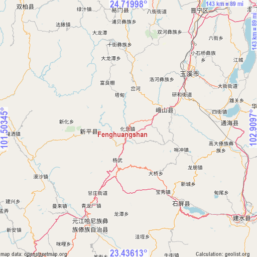
Fenghuangshan GPS coordinates[2]
24° 4' 46.776" North, 102° 12' 23.652" East
| Map corner | latitude | longitude |
|---|---|---|
| Upper-left | 24.71998°, | 101.50345° |
| Center: | 24.07966°, | 102.20657° |
| Lower-right: | 23.43613°, | 102.9097° |
| Map W x H: | 142.8×142.8 km | = 88.7×88.7mi |
| max Lat: | 53.31946° ⇑90.2% North |
| Fenghuangshan: | 24.07966° |
| min Lat: | ⇓9.8% South 18.22056° |
| min Long | Fenghuangshan | max Long |
| 75.07348° | 102.20657° | 134.28917° |
| W 7.4%⇐ | ⇒92.6% E |
Elevation
Elevation of Fenghuangshan is 1133 m = 3717 ft, and this is 648.2 m = 2127 ft above average elevation for this country.
| Max E: |
5622 m = 18445 ft | 12.7% |
| Fenghuangshan | 1133 m 3717 ft | |
| Avg. | 484.8 m = 1591 ft | |
Min E: |
-3 m = -10 ft | 87.3% |
See also: China elevation on elevation.city.
Geographical zone
Fenghuangshan is located in North temperate zone (between Tropic of Cancer and the Arctic Circle). Distance of this Northern Tropic circle is 71.5 km =44.4 mi to South.| Distance of | km | miles | from Fenghuangshan |
|---|---|---|---|
| North Pole | 7329.7 | 4554.5 | to North |
| Arctic Circle | 4723.8 | 2935.2 | to North |
| Tropic Cancer | 71.5 | 44.4 | to South |
| Equator | 2677.4 | 1663.7 | to South |


Nearby cities:
15 places around Fenghuangshan: (largest is in red/bold)
• Chahe
23.1 km =14.4 mi,  11°
11°
• Dalongtan
40.8 km =25.4 mi,  345°
345°
• Dayingjie
41 km =25.5 mi,  45°
45°
• Dianzhong
36.2 km =22.5 mi,  2°
2°
• Fuliangpengjie
28.8 km =17.9 mi,  335°
335°
• Gaocang
41.8 km =26 mi, 49°
• Guishan
21.2 km =13.2 mi,  261°
261°
• Hexi
45.4 km =28.2 mi,  80°
80°
• Longwu
21.5 km =13.4 mi,  113°
113°
• Luohe
33.5 km =20.8 mi,  33°
33°
• Shuangjiang
22.2 km =13.8 mi,  62°
62°
• Tadianjie
19.4 km =12.1 mi, 345°
• Xiaojie
27.3 km =17 mi,  71°
71°
• Xiyang
43.6 km =27.1 mi, 11°
• Yanhe
35.5 km =22.1 mi, 55°
Sources, notices
• [Note1] Compared only with cities in China existing in our database
• [Src1] Map data: © OpenStreetMap contributors (CC-BY-SA)
• [Src2] Other city data from geonames.org with taken over terms of usage.
• [Src3] Geographical zone / Annual Mean Temperature by Robert A. Rohde @ Wikipedia
