Fuliangpengjie geodata
Fuliangpengjie (Yunnan) is a seat of a fourth-order administrative division; located in China in Asia/Shanghai (GMT+8) time zone. In our database, there are 1268 cities with bigger population. Compared to other cities in China, 89.1% of cities are located further ↑North; 92.7% of cities are located further →East and 94.4% of cities have lower elevation than Fuliangpengjie. Note1


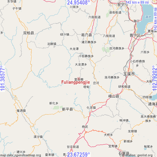
Fuliangpengjie GPS coordinates[2]
24° 18' 53.82" North, 102° 5' 20.004" East
| Map corner | latitude | longitude |
|---|---|---|
| Upper-left | 24.95408°, | 101.38577° |
| Center: | 24.31495°, | 102.08889° |
| Lower-right: | 23.67259°, | 102.79202° |
| Map W x H: | 142.5×142.5 km | = 88.5×88.5mi |
| max Lat: | 53.31946° ⇑89.1% North |
| Fuliangpengjie: | 24.31495° |
| min Lat: | ⇓10.9% South 18.22056° |
| min Long | Fuliangpengjie | max Long |
| 75.07348° | 102.08889° | 134.28917° |
| W 7.3%⇐ | ⇒92.7% E |
Elevation
Elevation of Fuliangpengjie is 1937 m = 6355 ft, and this is 1452.2 m = 4764 ft above average elevation for this country.
| Max E: |
5622 m = 18445 ft | 5.6% |
| Fuliangpengjie | 1937 m 6355 ft | |
| Avg. | 484.8 m = 1591 ft | |
Min E: |
-3 m = -10 ft | 94.4% |
See also: China elevation on elevation.city.
Geographical zone
Fuliangpengjie is located in North temperate zone (between Tropic of Cancer and the Arctic Circle). Distance of this Northern Tropic circle is 97.7 km =60.7 mi to South.| Distance of | km | miles | from Fuliangpengjie |
|---|---|---|---|
| North Pole | 7303.5 | 4538.2 | to North |
| Arctic Circle | 4697.6 | 2919 | to North |
| Tropic Cancer | 97.7 | 60.7 | to South |
| Equator | 2703.6 | 1679.9 | to South |


Nearby cities:
15 places around Fuliangpengjie: (largest is in red/bold)
• Chahe
16.8 km =10.4 mi,  102°
102°
• Dalongtan
13.6 km =8.5 mi,  8°
8°
• Dayingjie
41.2 km =25.6 mi,  86°
86°
• Dianzhong
17 km =10.6 mi,  53°
53°
• Fenghuangshan
28.8 km =17.9 mi,  155°
155°
• Guishan
30.8 km =19.1 mi,  197°
197°
• Longquan
40.4 km =25.1 mi, 10°
• Luohe
30.5 km =19 mi, 86°
• Shijie
22 km =13.7 mi,  18°
18°
• Shuangjiang
35.3 km =21.9 mi,  116°
116°
• Tadianjie
10.3 km =6.4 mi,  136°
136°
• Xiaojie
41.6 km =25.8 mi,  114°
114°
• Xinjiezi
34.9 km =21.7 mi, 15°
• Xiyang
26.3 km =16.3 mi, 50°
• Yanhe
41.7 km =25.9 mi, 98°
Sources, notices
• [Note1] Compared only with cities in China existing in our database
• [Src1] Map data: © OpenStreetMap contributors (CC-BY-SA)
• [Src2] Other city data from geonames.org with taken over terms of usage.
• [Src3] Geographical zone / Annual Mean Temperature by Robert A. Rohde @ Wikipedia
