Dianzhong geodata
Dianzhong (Yunnan) is a seat of a fourth-order administrative division; located in China in Asia/Shanghai (GMT+8) time zone. In our database, there are 1268 cities with bigger population. Compared to other cities in China, 88.8% of cities are located further ↑North; 92.6% of cities are located further →East and 92.2% of cities have lower elevation than Dianzhong. Note1


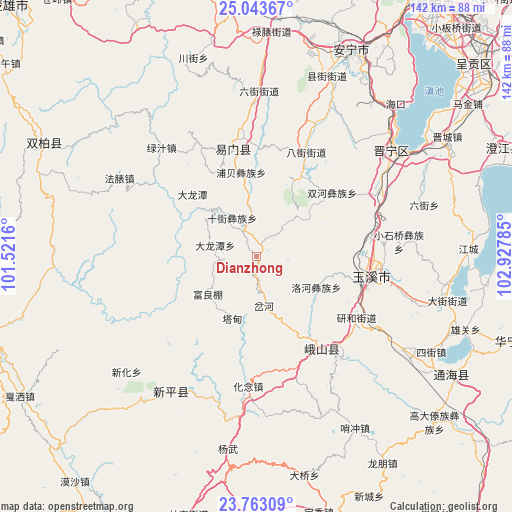
Dianzhong GPS coordinates[2]
24° 24' 18" North, 102° 13' 28.992" East
| Map corner | latitude | longitude |
|---|---|---|
| Upper-left | 25.04367°, | 101.5216° |
| Center: | 24.405°, | 102.22472° |
| Lower-right: | 23.76309°, | 102.92785° |
| Map W x H: | 142.4×142.4 km | = 88.5×88.5mi |
| max Lat: | 53.31946° ⇑88.8% North |
| Dianzhong: | 24.405° |
| min Lat: | ⇓11.2% South 18.22056° |
| min Long | Dianzhong | max Long |
| 75.07348° | 102.22472° | 134.28917° |
| W 7.4%⇐ | ⇒92.6% E |
Elevation
Elevation of Dianzhong is 1600 m = 5249 ft, and this is 1115.2 m = 3659 ft above average elevation for this country.
| Max E: |
5622 m = 18445 ft | 7.8% |
| Dianzhong | 1600 m 5249 ft | |
| Avg. | 484.8 m = 1591 ft | |
Min E: |
-3 m = -10 ft | 92.2% |
See also: China elevation on elevation.city.
Geographical zone
Dianzhong is located in North temperate zone (between Tropic of Cancer and the Arctic Circle). Distance of this Northern Tropic circle is 107.7 km =66.9 mi to South.| Distance of | km | miles | from Dianzhong |
|---|---|---|---|
| North Pole | 7293.5 | 4532 | to North |
| Arctic Circle | 4687.6 | 2912.7 | to North |
| Tropic Cancer | 107.7 | 66.9 | to South |
| Equator | 2713.6 | 1686.2 | to South |


Nearby cities:
15 places around Dianzhong: (largest is in red/bold)
• Chahe
13.8 km =8.6 mi,  168°
168°
• Chunhe
31 km =19.3 mi,  90°
90°
• Dalongtan
12.3 km =7.6 mi,  286°
286°
• Dayingjie
28.4 km =17.6 mi,  105°
105°
• Fuliangpengjie
17 km =10.6 mi,  233°
233°
• Gaocang
31.5 km =19.6 mi, 107°
• Longquan
30.4 km =18.9 mi,  347°
347°
• Luohe
18.6 km =11.6 mi,  116°
116°
• Shijie
12.7 km =7.9 mi,  328°
328°
• Shuanghejie
28 km =17.4 mi,  50°
50°
• Shuangjiang
31.4 km =19.5 mi,  145°
145°
• Tadianjie
18.6 km =11.6 mi,  200°
200°
• Xinjiezi
24 km =14.9 mi, 349°
• Xiyang
9.4 km =5.8 mi, 45°
• Yanhe
31.9 km =19.8 mi, 120°
Sources, notices
• [Note1] Compared only with cities in China existing in our database
• [Src1] Map data: © OpenStreetMap contributors (CC-BY-SA)
• [Src2] Other city data from geonames.org with taken over terms of usage.
• [Src3] Geographical zone / Annual Mean Temperature by Robert A. Rohde @ Wikipedia
