Shuangjiang geodata
Shuangjiang (Yunnan) is a seat of a third-order administrative division; located in China in Asia/Shanghai (GMT+8) time zone. In our database, there are 1268 cities with bigger population. Compared to other cities in China, 89.7% of cities are located further ↑North; 92.4% of cities are located further →East and 91.8% of cities have lower elevation than Shuangjiang. Note1


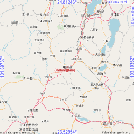
Shuangjiang GPS coordinates[2]
24° 10' 21.396" North, 102° 24' 1.764" East
| Map corner | latitude | longitude |
|---|---|---|
| Upper-left | 24.81246°, | 101.69737° |
| Center: | 24.17261°, | 102.40049° |
| Lower-right: | 23.52954°, | 103.10362° |
| Map W x H: | 142.6×142.6 km | = 88.6×88.6mi |
| max Lat: | 53.31946° ⇑89.7% North |
| Shuangjiang: | 24.17261° |
| min Lat: | ⇓10.3% South 18.22056° |
| min Long | Shuangjiang | max Long |
| 75.07348° | 102.40049° | 134.28917° |
| W 7.6%⇐ | ⇒92.4% E |
Elevation
Elevation of Shuangjiang is 1544 m = 5066 ft, and this is 1059.2 m = 3475 ft above average elevation for this country.
| Max E: |
5622 m = 18445 ft | 8.2% |
| Shuangjiang | 1544 m 5066 ft | |
| Avg. | 484.8 m = 1591 ft | |
Min E: |
-3 m = -10 ft | 91.8% |
See also: China elevation on elevation.city.
Geographical zone
Shuangjiang is located in North temperate zone (between Tropic of Cancer and the Arctic Circle). Distance of this Northern Tropic circle is 81.8 km =50.8 mi to South.| Distance of | km | miles | from Shuangjiang |
|---|---|---|---|
| North Pole | 7319.3 | 4548 | to North |
| Arctic Circle | 4713.4 | 2928.8 | to North |
| Tropic Cancer | 81.8 | 50.8 | to South |
| Equator | 2687.7 | 1670.1 | to South |


Nearby cities:
15 places around Shuangjiang: (largest is in red/bold)
• Baigecun
26.8 km =16.7 mi,  93°
93°
• Chahe
19.5 km =12.1 mi,  309°
309°
• Chunhe
28.8 km =17.9 mi,  27°
27°
• Dayingjie
20.8 km =12.9 mi, 27°
• Dayingjie
28.4 km =17.6 mi,  58°
58°
• Fenghuangshan
22.2 km =13.8 mi,  242°
242°
• Gaocang
20.7 km =12.9 mi,  36°
36°
• Hexi
25.4 km =15.8 mi,  97°
97°
• Liqi
28.5 km =17.7 mi, 32°
• Longwu
19 km =11.8 mi,  180°
180°
• Luohe
17.6 km =10.9 mi,  356°
356°
• Tadianjie
25.9 km =16.1 mi,  288°
288°
• Xiaojie
6.4 km =4 mi, 104°
• Yanhe
13.6 km =8.5 mi,  45°
45°
• Yuxi
24.9 km =15.5 mi, 35°
Sources, notices
• [Note1] Compared only with cities in China existing in our database
• [Src1] Map data: © OpenStreetMap contributors (CC-BY-SA)
• [Src2] Other city data from geonames.org with taken over terms of usage.
• [Src3] Geographical zone / Annual Mean Temperature by Robert A. Rohde @ Wikipedia
