Huangzhan geodata
Huangzhan (Hubei) is a seat of a fourth-order administrative division; located in China in Asia/Shanghai (GMT+8) time zone. In our database, there are 1268 cities with bigger population. Compared to other cities in China, 58.9% of cities are located further ↓South; 51.6% of cities are located further ←West and 60.1% of cities have higher elevation than Huangzhan. Note1


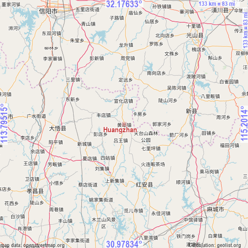
Huangzhan GPS coordinates[2]
31° 34' 45.336" North, 114° 29' 53.772" East
| Map corner | latitude | longitude |
|---|---|---|
| Upper-left | 32.17633°, | 113.79515° |
| Center: | 31.57926°, | 114.49827° |
| Lower-right: | 30.97834°, | 115.2014° |
| Map W x H: | 133.2×133.2 km | = 82.8×82.8mi |
| max Lat: | 53.31946° ⇑41.1% North |
| Huangzhan: | 31.57926° |
| min Lat: | ⇓58.9% South 18.22056° |
| min Long | Huangzhan | max Long |
| 75.07348° | 114.49827° | 134.28917° |
| W 51.6%⇐ | ⇒48.4% E |
Elevation
Elevation of Huangzhan is 98 m = 322 ft, and this is 386.8 m = 1269 ft below average elevation for this country.
| Max E: |
5622 m = 18445 ft | 60.1% |
| Avg. | 484.8 m = 1591 ft | |
| Huangzhan | 98 m = 322 ft | |
Min E: |
-3 m = -10 ft | 39.9% |
See also: China elevation on elevation.city.
Geographical zone
Huangzhan is located in North temperate zone (between Tropic of Cancer and the Arctic Circle). Distance of this Northern Tropic circle is 905.4 km =562.6 mi to South.| Distance of | km | miles | from Huangzhan |
|---|---|---|---|
| North Pole | 6495.8 | 4036.3 | to North |
| Arctic Circle | 3889.9 | 2417.1 | to North |
| Tropic Cancer | 905.4 | 562.6 | to South |
| Equator | 3511.3 | 2181.8 | to South |


Nearby cities:
15 places around Huangzhan: (largest is in red/bold)
• Dongxin
30.7 km =19.1 mi,  296°
296°
• Fengdian
12.2 km =7.6 mi,  294°
294°
• Gaodian
25.6 km =15.9 mi,  272°
272°
• Hekou
29.8 km =18.5 mi,  192°
192°
• Hong’an Chengguanzhen
27.5 km =17.1 mi,  151°
151°
• Huajiahe
13.4 km =8.3 mi,  167°
167°
• Liuji
26.4 km =16.4 mi,  207°
207°
• Luwang
8.4 km =5.2 mi, 194°
• Pengdian
13.7 km =8.5 mi,  248°
248°
• Qiliping
19.1 km =11.9 mi,  131°
131°
• Shangxinji
30.2 km =18.8 mi, 190°
• Sigu
20.1 km =12.5 mi, 206°
• Xiadian
26.5 km =16.5 mi,  226°
226°
• Xincheng
24.3 km =15.1 mi, 245°
• Xuanhuadian
13 km =8.1 mi,  357°
357°
Sources, notices
• [Note1] Compared only with cities in China existing in our database
• [Src1] Map data: © OpenStreetMap contributors (CC-BY-SA)
• [Src2] Other city data from geonames.org with taken over terms of usage.
• [Src3] Geographical zone / Annual Mean Temperature by Robert A. Rohde @ Wikipedia
