Huaihe geodata
Huaihe (Hubei) is a seat of a fourth-order administrative division; located in China in Asia/Shanghai (GMT+8) time zone. In our database, there are 1268 cities with bigger population. Compared to other cities in China, 63.3% of cities are located further ↓South; 53.7% of cities are located further →East and 55.4% of cities have higher elevation than Huaihe. Note1


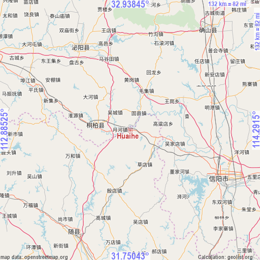
Huaihe GPS coordinates[2]
32° 20' 47.004" North, 113° 35' 18.132" East
| Map corner | latitude | longitude |
|---|---|---|
| Upper-left | 32.93845°, | 112.88525° |
| Center: | 32.34639°, | 113.58837° |
| Lower-right: | 31.75043°, | 114.2915° |
| Map W x H: | 132.1×132.1 km | = 82.1×82.1mi |
| max Lat: | 53.31946° ⇑36.7% North |
| Huaihe: | 32.34639° |
| min Lat: | ⇓63.3% South 18.22056° |
| min Long | Huaihe | max Long |
| 75.07348° | 113.58837° | 134.28917° |
| W 46.3%⇐ | ⇒53.7% E |
Elevation
Elevation of Huaihe is 129 m = 423 ft, and this is 355.8 m = 1167 ft below average elevation for this country.
| Max E: |
5622 m = 18445 ft | 55.4% |
| Avg. | 484.8 m = 1591 ft | |
| Huaihe | 129 m = 423 ft | |
Min E: |
-3 m = -10 ft | 44.6% |
See also: China elevation on elevation.city.
Geographical zone
Huaihe is located in North temperate zone (between Tropic of Cancer and the Arctic Circle). Distance of this Northern Tropic circle is 990.7 km =615.6 mi to South.| Distance of | km | miles | from Huaihe |
|---|---|---|---|
| North Pole | 6410.5 | 3983.3 | to North |
| Arctic Circle | 3804.6 | 2364.1 | to North |
| Tropic Cancer | 990.7 | 615.6 | to South |
| Equator | 3596.6 | 2234.8 | to South |


Nearby cities:
15 places around Huaihe: (largest is in red/bold)
• Caodian
18.5 km =11.5 mi,  156°
156°
• Chenzhuang
44 km =27.3 mi,  321°
321°
• Fujia
39 km =24.2 mi,  233°
233°
• Gaocheng
46.5 km =28.9 mi,  197°
197°
• Gaodian
46.4 km =28.8 mi,  314°
314°
• Gaoyi
45.9 km =28.5 mi,  344°
344°
• Magutian
38 km =23.6 mi, 343°
• Minggang
45 km =28 mi,  73°
73°
• Tianhekou
27.7 km =17.2 mi,  208°
208°
• Tongbai Chengguanzhen
18.1 km =11.2 mi,  276°
276°
• Wanhe
31.9 km =19.8 mi,  246°
246°
• Wudian
46.8 km =29.1 mi,  173°
173°
• Xiaolin
13 km =8.1 mi,  105°
105°
• Xincheng
36.9 km =22.9 mi,  270°
270°
• Yindian
31.5 km =19.6 mi,  194°
194°
Sources, notices
• [Note1] Compared only with cities in China existing in our database
• [Src1] Map data: © OpenStreetMap contributors (CC-BY-SA)
• [Src2] Other city data from geonames.org with taken over terms of usage.
• [Src3] Geographical zone / Annual Mean Temperature by Robert A. Rohde @ Wikipedia
