Huaibei geodata
Huaibei (Anhui) is a populated place; located in China in Asia/Shanghai (GMT+8) time zone. With population of 903,039 people, there are 69 cities with bigger population in this country. Compared to other cities in China, 70% of cities are located further ↓South; 64.9% of cities are located further ←West and 70.3% of cities have higher elevation than Huaibei. Note1


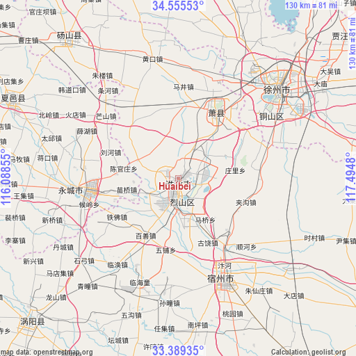
Huaibei GPS coordinates[2]
33° 58' 27.984" North, 116° 47' 30.012" East
| Map corner | latitude | longitude |
|---|---|---|
| Upper-left | 34.55553°, | 116.08855° |
| Center: | 33.97444°, | 116.79167° |
| Lower-right: | 33.38935°, | 117.4948° |
| Map W x H: | 129.7×129.7 km | = 80.6×80.6mi |
| max Lat: | 53.31946° ⇑30% North |
| Huaibei: | 33.97444° |
| min Lat: | ⇓70% South 18.22056° |
| min Long | Huaibei | max Long |
| 75.07348° | 116.79167° | 134.28917° |
| W 64.9%⇐ | ⇒35.1% E |
Elevation
Elevation of Huaibei is 51 m = 167 ft, and this is 433.8 m = 1423 ft below average elevation for this country.
| Max E: |
5622 m = 18445 ft | 70.3% |
| Avg. | 484.8 m = 1591 ft | |
| Huaibei | 51 m = 167 ft | |
Min E: |
-3 m = -10 ft | 29.7% |
See also: Huaibei elevation on elevation.city.
Geographical zone
Huaibei is located in North temperate zone (between Tropic of Cancer and the Arctic Circle). Distance of this Northern Tropic circle is 1171.7 km =728.1 mi to South.| Distance of | km | miles | from Huaibei |
|---|---|---|---|
| North Pole | 6229.5 | 3870.8 | to North |
| Arctic Circle | 3623.6 | 2251.6 | to North |
| Tropic Cancer | 1171.7 | 728.1 | to South |
| Equator | 3777.6 | 2347.3 | to South |


Nearby cities:
15 places around Huaibei: (largest is in red/bold)
• Bolinzi
67.9 km =42.2 mi,  110°
110°
• Dangcheng
63.2 km =39.3 mi,  322°
322°
• Duji
4.3 km =2.7 mi,  52°
52°
• Fengxian
83.3 km =51.8 mi,  346°
346°
• Guoyang Chengguanzhen
73.5 km =45.7 mi,  224°
224°
• Jiuli
47.6 km =29.6 mi,  41°
41°
• Longcheng
27.6 km =17.1 mi,  32°
32°
• Mengcheng Chengguanzhen
81.5 km =50.6 mi,  194°
194°
• Suixi
9.4 km =5.8 mi, 189°
• Suzhou
41.4 km =25.7 mi,  155°
155°
• Tangzhai
54.2 km =33.7 mi,  340°
340°
• Tongshan
40.7 km =25.3 mi,  55°
55°
• Xiayi Chengguanzhen
68.7 km =42.7 mi,  295°
295°
• Xuzhou
52 km =32.3 mi, 60°
• Yanji
31.4 km =19.5 mi,  268°
268°
Sources, notices
• [Note1] Compared only with cities in China existing in our database
• [Src1] Map data: © OpenStreetMap contributors (CC-BY-SA)
• [Src2] Other city data from geonames.org with taken over terms of usage.
• [Src3] Geographical zone / Annual Mean Temperature by Robert A. Rohde @ Wikipedia
