Dangcheng geodata
Dangcheng (Anhui) is a seat of a third-order administrative division; located in China in Asia/Shanghai (GMT+8) time zone. In our database, there are 1268 cities with bigger population. Compared to other cities in China, 72.3% of cities are located further ↓South; 62.3% of cities are located further ←West and 71.6% of cities have higher elevation than Dangcheng. Note1


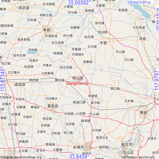
Dangcheng GPS coordinates[2]
34° 25' 40.332" North, 116° 22' 35.652" East
| Map corner | latitude | longitude |
|---|---|---|
| Upper-left | 35.00582°, | 115.67345° |
| Center: | 34.42787°, | 116.37657° |
| Lower-right: | 33.8459°, | 117.0797° |
| Map W x H: | 129×129 km | = 80.2×80.2mi |
| max Lat: | 53.31946° ⇑27.7% North |
| Dangcheng: | 34.42787° |
| min Lat: | ⇓72.3% South 18.22056° |
| min Long | Dangcheng | max Long |
| 75.07348° | 116.37657° | 134.28917° |
| W 62.3%⇐ | ⇒37.7% E |
Elevation
Elevation of Dangcheng is 46 m = 151 ft, and this is 438.8 m = 1440 ft below average elevation for this country.
| Max E: |
5622 m = 18445 ft | 71.6% |
| Avg. | 484.8 m = 1591 ft | |
| Dangcheng | 46 m = 151 ft | |
Min E: |
-3 m = -10 ft | 28.4% |
See also: China elevation on elevation.city.
Geographical zone
Dangcheng is located in North temperate zone (between Tropic of Cancer and the Arctic Circle). Distance of this Northern Tropic circle is 1222.1 km =759.4 mi to South.| Distance of | km | miles | from Dangcheng |
|---|---|---|---|
| North Pole | 6179 | 3839.5 | to North |
| Arctic Circle | 3573.2 | 2220.3 | to North |
| Tropic Cancer | 1222.1 | 759.4 | to South |
| Equator | 3828 | 2378.6 | to South |


Nearby cities:
15 places around Dangcheng: (largest is in red/bold)
• Chengwu
73.8 km =45.9 mi,  322°
322°
• Chezhan
32.4 km =20.1 mi,  265°
265°
• Duji
63.4 km =39.4 mi,  139°
139°
• Fengxian
36.2 km =22.5 mi,  32°
32°
• Huaibei
63.2 km =39.3 mi, 142°
• Jiuli
71.4 km =44.4 mi,  102°
102°
• Longcheng
59.3 km =36.8 mi,  117°
117°
• Peicheng
60.8 km =37.8 mi,  55°
55°
• Shancheng
49 km =30.4 mi,  326°
326°
• Shangqiu
66.7 km =41.4 mi, 272°
• Suixi
70.1 km =43.6 mi,  148°
148°
• Tangzhai
19.7 km =12.2 mi,  88°
88°
• Xiayi Chengguanzhen
32 km =19.9 mi,  228°
228°
• Yanji
51.9 km =32.2 mi,  172°
172°
• Yucheng
56.3 km =35 mi,  8°
8°
Sources, notices
• [Note1] Compared only with cities in China existing in our database
• [Src1] Map data: © OpenStreetMap contributors (CC-BY-SA)
• [Src2] Other city data from geonames.org with taken over terms of usage.
• [Src3] Geographical zone / Annual Mean Temperature by Robert A. Rohde @ Wikipedia
