Hongxi geodata
Hongxi (Yunnan) is a seat of a fourth-order administrative division; located in China in Asia/Shanghai (GMT+8) time zone. In our database, there are 1268 cities with bigger population. Compared to other cities in China, 89.9% of cities are located further ↑North; 91.1% of cities are located further →East and 91.1% of cities have lower elevation than Hongxi. Note1


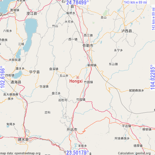
Hongxi GPS coordinates[2]
24° 8' 42" North, 103° 19' 10.992" East
| Map corner | latitude | longitude |
|---|---|---|
| Upper-left | 24.78499°, | 102.6166° |
| Center: | 24.145°, | 103.31972° |
| Lower-right: | 23.50179°, | 104.02285° |
| Map W x H: | 142.7×142.7 km | = 88.7×88.7mi |
| max Lat: | 53.31946° ⇑89.9% North |
| Hongxi: | 24.145° |
| min Lat: | ⇓10.1% South 18.22056° |
| min Long | Hongxi | max Long |
| 75.07348° | 103.31972° | 134.28917° |
| W 8.9%⇐ | ⇒91.1% E |
Elevation
Elevation of Hongxi is 1460 m = 4790 ft, and this is 975.2 m = 3199 ft above average elevation for this country.
| Max E: |
5622 m = 18445 ft | 8.9% |
| Hongxi | 1460 m 4790 ft | |
| Avg. | 484.8 m = 1591 ft | |
Min E: |
-3 m = -10 ft | 91.1% |
See also: China elevation on elevation.city.
Geographical zone
Hongxi is located in North temperate zone (between Tropic of Cancer and the Arctic Circle). Distance of this Northern Tropic circle is 78.8 km =49 mi to South.| Distance of | km | miles | from Hongxi |
|---|---|---|---|
| North Pole | 7322.4 | 4549.9 | to North |
| Arctic Circle | 4716.5 | 2930.7 | to North |
| Tropic Cancer | 78.8 | 49 | to South |
| Equator | 2684.7 | 1668.2 | to South |


Nearby cities:
15 places around Hongxi: (largest is in red/bold)
• Daxinshao
17.1 km =10.6 mi,  51°
51°
• Huakoulongtan
40.7 km =25.3 mi,  13°
13°
• Huaxijie
32 km =19.9 mi,  255°
255°
• Kaiyuan
49.8 km =30.9 mi,  181°
181°
• Miyang
31.4 km =19.5 mi,  23°
23°
• Ningzhou
41.1 km =25.5 mi,  276°
276°
• Panjiang
24.2 km =15 mi,  234°
234°
• Qinglong
47.6 km =29.6 mi,  314°
314°
• Qingnianlu
24.1 km =15 mi,  291°
291°
• Sijia
12.8 km =8 mi, 280°
• Tonghong
33.2 km =20.6 mi, 310°
• Xiaojiezi
51.3 km =31.9 mi,  295°
295°
• Xilong
33.9 km =21.1 mi,  334°
334°
• Youzha
36 km =22.4 mi,  352°
352°
• Zhuyuan
10.9 km =6.8 mi,  112°
112°
Sources, notices
• [Note1] Compared only with cities in China existing in our database
• [Src1] Map data: © OpenStreetMap contributors (CC-BY-SA)
• [Src2] Other city data from geonames.org with taken over terms of usage.
• [Src3] Geographical zone / Annual Mean Temperature by Robert A. Rohde @ Wikipedia
