Haozhai geodata
Haozhai (Henan) is a seat of a fourth-order administrative division; located in China in Asia/Shanghai (GMT+8) time zone. In our database, there are 1268 cities with bigger population. Compared to other cities in China, 66.1% of cities are located further ↓South; 57.4% of cities are located further →East and 54.2% of cities have higher elevation than Haozhai. Note1


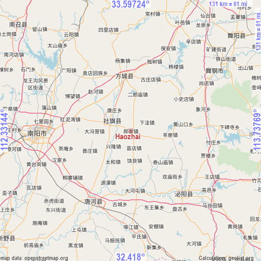
Haozhai GPS coordinates[2]
33° 0' 34.524" North, 113° 2' 4.416" East
| Map corner | latitude | longitude |
|---|---|---|
| Upper-left | 33.59724°, | 112.33144° |
| Center: | 33.00959°, | 113.03456° |
| Lower-right: | 32.418°, | 113.73769° |
| Map W x H: | 131.1×131.1 km | = 81.5×81.5mi |
| max Lat: | 53.31946° ⇑33.9% North |
| Haozhai: | 33.00959° |
| min Lat: | ⇓66.1% South 18.22056° |
| min Long | Haozhai | max Long |
| 75.07348° | 113.03456° | 134.28917° |
| W 42.6%⇐ | ⇒57.4% E |
Elevation
Elevation of Haozhai is 136 m = 446 ft, and this is 348.8 m = 1144 ft below average elevation for this country.
| Max E: |
5622 m = 18445 ft | 54.2% |
| Avg. | 484.8 m = 1591 ft | |
| Haozhai | 136 m = 446 ft | |
Min E: |
-3 m = -10 ft | 45.8% |
See also: China elevation on elevation.city.
Geographical zone
Haozhai is located in North temperate zone (between Tropic of Cancer and the Arctic Circle). Distance of this Northern Tropic circle is 1064.4 km =661.4 mi to South.| Distance of | km | miles | from Haozhai |
|---|---|---|---|
| North Pole | 6336.7 | 3937.4 | to North |
| Arctic Circle | 3730.9 | 2318.3 | to North |
| Tropic Cancer | 1064.4 | 661.4 | to South |
| Equator | 3670.3 | 2280.6 | to South |


Nearby cities:
15 places around Haozhai: (largest is in red/bold)
• Chengjiao
11.1 km =6.9 mi,  293°
293°
• Dafengying
18 km =11.2 mi,  268°
268°
• Fangcheng Chengguanzhen
27.3 km =17 mi,  353°
353°
• Guanzhuang
27.9 km =17.3 mi,  119°
119°
• Guoji
8.9 km =5.5 mi,  113°
113°
• Huangshankou
26.6 km =16.5 mi,  82°
82°
• Qiaotou
21.5 km =13.4 mi,  283°
283°
• Qinghe
29.4 km =18.3 mi,  335°
335°
• Shedian
10.3 km =6.4 mi,  303°
303°
• Shuangmiaojie
31 km =19.3 mi,  137°
137°
• Taishanmiao
22.5 km =14 mi,  133°
133°
• Tangzhuang
13.2 km =8.2 mi,  322°
322°
• Xuanqiao
17.3 km =10.7 mi, 336°
• Yangce
19.9 km =12.4 mi,  95°
95°
• Zhaohe
26.5 km =16.5 mi, 318°
Sources, notices
• [Note1] Compared only with cities in China existing in our database
• [Src1] Map data: © OpenStreetMap contributors (CC-BY-SA)
• [Src2] Other city data from geonames.org with taken over terms of usage.
• [Src3] Geographical zone / Annual Mean Temperature by Robert A. Rohde @ Wikipedia
