Changzhi geodata
Changzhi (Shanxi) is a seat of a second-order administrative division; located in China in Asia/Shanghai (GMT+8) time zone. In our database, there are 1268 cities with bigger population. Compared to other cities in China, 77.6% of cities are located further ↓South; 56.9% of cities are located further →East and 84.3% of cities have lower elevation than Changzhi. Note1


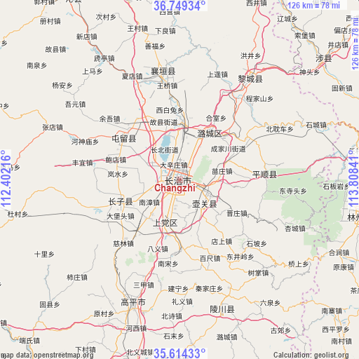
Changzhi GPS coordinates[2]
36° 11' 2.004" North, 113° 6' 19.008" East
| Map corner | latitude | longitude |
|---|---|---|
| Upper-left | 36.74934°, | 112.40216° |
| Center: | 36.18389°, | 113.10528° |
| Lower-right: | 35.61433°, | 113.80841° |
| Map W x H: | 126.2×126.2 km | = 78.4×78.4mi |
| max Lat: | 53.31946° ⇑22.4% North |
| Changzhi: | 36.18389° |
| min Lat: | ⇓77.6% South 18.22056° |
| min Long | Changzhi | max Long |
| 75.07348° | 113.10528° | 134.28917° |
| W 43.1%⇐ | ⇒56.9% E |
Elevation
Elevation of Changzhi is 937 m = 3074 ft, and this is 452.2 m = 1484 ft above average elevation for this country.
| Max E: |
5622 m = 18445 ft | 15.7% |
| Changzhi | 937 m 3074 ft | |
| Avg. | 484.8 m = 1591 ft | |
Min E: |
-3 m = -10 ft | 84.3% |
See also: China elevation on elevation.city.
Geographical zone
Changzhi is located in North temperate zone (between Tropic of Cancer and the Arctic Circle). Distance of this Northern Tropic circle is 1417.4 km =880.7 mi to South.| Distance of | km | miles | from Changzhi |
|---|---|---|---|
| North Pole | 5983.8 | 3718.2 | to North |
| Arctic Circle | 3377.9 | 2098.9 | to North |
| Tropic Cancer | 1417.4 | 880.7 | to South |
| Equator | 4023.3 | 2500 | to South |


Nearby cities:
15 places around Changzhi: (largest is in red/bold)
• Beishidian
73.3 km =45.5 mi,  195°
195°
• Chongwen
47.3 km =29.4 mi,  163°
163°
• Danzhu
22.9 km =14.2 mi,  253°
253°
• Daxinzhuang
5.8 km =3.6 mi,  340°
340°
• Dingchang
74.5 km =46.3 mi,  329°
329°
• Fengzhou
76.6 km =47.6 mi, 342°
• Guhan
39.7 km =24.7 mi,  349°
349°
• Handian
16.3 km =10.1 mi, 199°
• Jincun
77.9 km =48.4 mi,  193°
193°
• Kaiyuan
65.7 km =40.8 mi,  101°
101°
• Lihou
42.6 km =26.5 mi,  33°
33°
• Linjiang
25.6 km =15.9 mi,  308°
308°
• Longquan
10.3 km =6.4 mi,  135°
135°
• Luhua
19.6 km =12.2 mi, 33°
• Qingyang
28.1 km =17.5 mi,  84°
84°
Sources, notices
• [Note1] Compared only with cities in China existing in our database
• [Src1] Map data: © OpenStreetMap contributors (CC-BY-SA)
• [Src2] Other city data from geonames.org with taken over terms of usage.
• [Src3] Geographical zone / Annual Mean Temperature by Robert A. Rohde @ Wikipedia
