Lingbao Chengguanzhen geodata
Lingbao Chengguanzhen (Henan) is a seat of a third-order administrative division; located in China in Asia/Shanghai (GMT+8) time zone. In our database, there are 1268 cities with bigger population. Compared to other cities in China, 72.8% of cities are located further ↓South; 67.6% of cities are located further →East and 69.8% of cities have lower elevation than Lingbao Chengguanzhen. Note1


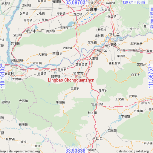
Lingbao Chengguanzhen GPS coordinates[2]
34° 31' 10.992" North, 110° 51' 51.984" East
| Map corner | latitude | longitude |
|---|---|---|
| Upper-left | 35.09703°, | 110.16132° |
| Center: | 34.51972°, | 110.86444° |
| Lower-right: | 33.93838°, | 111.56757° |
| Map W x H: | 128.8×128.8 km | = 80×80mi |
| max Lat: | 53.31946° ⇑27.2% North |
| Lingbao Chengguanzhen: | 34.51972° |
| min Lat: | ⇓72.8% South 18.22056° |
| min Long | Lingbao Chenggu | max Long |
| 75.07348° | 110.86444° | 134.28917° |
| W 32.4%⇐ | ⇒67.6% E |
Elevation
Elevation of Lingbao Chengguanzhen is 407 m = 1335 ft, and this is 77.8 m = 255 ft below average elevation for this country.
| Max E: |
5622 m = 18445 ft | 30.2% |
| Avg. | 484.8 m = 1591 ft | |
| Lingbao Chengguanzhen | 407 m = 1335 ft | |
Min E: |
-3 m = -10 ft | 69.8% |
See also: China elevation on elevation.city.
Geographical zone
Lingbao Chengguanzhen is located in North temperate zone (between Tropic of Cancer and the Arctic Circle). Distance of this Northern Tropic circle is 1232.3 km =765.7 mi to South.| Distance of | km | miles | from Lingbao Chengguanzhen |
|---|---|---|---|
| North Pole | 6168.8 | 3833.1 | to North |
| Arctic Circle | 3562.9 | 2213.9 | to North |
| Tropic Cancer | 1232.3 | 765.7 | to South |
| Equator | 3838.2 | 2384.9 | to South |


Nearby cities:
15 places around Lingbao Chengguanzhen: (largest is in red/bold)
• Anyi
61.6 km =38.3 mi,  14°
14°
• Boshi
79.5 km =49.4 mi,  290°
290°
• Daying
31.3 km =19.4 mi,  44°
44°
• Fushui
83.5 km =51.9 mi,  272°
272°
• Guwei
28.4 km =17.6 mi,  318°
318°
• Huayang
80.6 km =50.1 mi,  261°
261°
• Huayin
73.3 km =45.5 mi, 273°
• Luoning Chengguanzhen
74 km =46 mi,  101°
101°
• Lushi Chengguanzhen
54.6 km =33.9 mi,  163°
163°
• Shengrenjian
46.9 km =29.1 mi, 39°
• Taoxia
81.2 km =50.5 mi, 271°
• Xizhai
76.8 km =47.7 mi,  283°
283°
• Yaofeng
75.8 km =47.1 mi,  24°
24°
• Yishi
72.6 km =45.1 mi,  351°
351°
• Yuncheng
57.2 km =35.5 mi, 11°
Sources, notices
• [Note1] Compared only with cities in China existing in our database
• [Src1] Map data: © OpenStreetMap contributors (CC-BY-SA)
• [Src2] Other city data from geonames.org with taken over terms of usage.
• [Src3] Geographical zone / Annual Mean Temperature by Robert A. Rohde @ Wikipedia
