Ganziping geodata
Ganziping (Hunan) is a seat of a fourth-order administrative division; located in China in Asia/Shanghai (GMT+8) time zone. In our database, there are 1268 cities with bigger population. Compared to other cities in China, 72.5% of cities are located further ↑North; 73% of cities are located further →East and 56.4% of cities have lower elevation than Ganziping. Note1


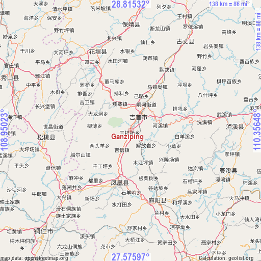
Ganziping GPS coordinates[2]
28° 11' 50.784" North, 109° 39' 12.06" East
| Map corner | latitude | longitude |
|---|---|---|
| Upper-left | 28.81532°, | 108.95023° |
| Center: | 28.19744°, | 109.65335° |
| Lower-right: | 27.57597°, | 110.35648° |
| Map W x H: | 137.8×137.8 km | = 85.6×85.6mi |
| max Lat: | 53.31946° ⇑72.5% North |
| Ganziping: | 28.19744° |
| min Lat: | ⇓27.5% South 18.22056° |
| min Long | Ganziping | max Long |
| 75.07348° | 109.65335° | 134.28917° |
| W 27%⇐ | ⇒73% E |
Elevation
Elevation of Ganziping is 220 m = 722 ft, and this is 264.8 m = 869 ft below average elevation for this country.
| Max E: |
5622 m = 18445 ft | 43.6% |
| Avg. | 484.8 m = 1591 ft | |
| Ganziping | 220 m = 722 ft | |
Min E: |
-3 m = -10 ft | 56.4% |
See also: China elevation on elevation.city.
Geographical zone
Ganziping is located in North temperate zone (between Tropic of Cancer and the Arctic Circle). Distance of this Northern Tropic circle is 529.3 km =328.9 mi to South.| Distance of | km | miles | from Ganziping |
|---|---|---|---|
| North Pole | 6871.8 | 4269.9 | to North |
| Arctic Circle | 4265.9 | 2650.7 | to North |
| Tropic Cancer | 529.3 | 328.9 | to South |
| Equator | 3135.3 | 1948.2 | to South |


Nearby cities:
15 places around Ganziping: (largest is in red/bold)
• Aizhai
15.4 km =9.6 mi,  338°
338°
• Datian
10.4 km =6.5 mi,  225°
225°
• Hexi
15.8 km =9.8 mi,  79°
79°
• Huoluping
15.2 km =9.4 mi,  246°
246°
• Jiefangyan
11.3 km =7 mi,  132°
132°
• Jixin
11 km =6.8 mi,  205°
205°
• Miliang
15.2 km =9.4 mi,  289°
289°
• Mujiangping
17.7 km =11 mi,  158°
158°
• Qianzhou
15.7 km =9.8 mi,  30°
30°
• Qiaoxikou
17.4 km =10.8 mi,  170°
170°
• Sangongqiao
1.1 km =0.7 mi, 207°
• Shetangpo
6.4 km =4 mi,  303°
303°
• Shuangtang
5.1 km =3.2 mi,  94°
94°
• Wanrongjiang
7.7 km =4.8 mi, 30°
• Zhaiyang
12.5 km =7.8 mi,  359°
359°
Sources, notices
• [Note1] Compared only with cities in China existing in our database
• [Src1] Map data: © OpenStreetMap contributors (CC-BY-SA)
• [Src2] Other city data from geonames.org with taken over terms of usage.
• [Src3] Geographical zone / Annual Mean Temperature by Robert A. Rohde @ Wikipedia
