Ganzhou geodata
Ganzhou (Jiangxi) is a seat of a fourth-order administrative division; located in China in Asia/Shanghai (GMT+8) time zone. In our database, there are 1268 cities with bigger population. Compared to other cities in China, 67% of cities are located further ↑North; 56.6% of cities are located further ←West and 72.7% of cities have higher elevation than Ganzhou. Note1


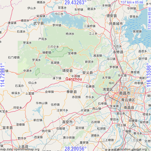
Ganzhou GPS coordinates[2]
28° 49' 6.312" North, 115° 25' 57.828" East
| Map corner | latitude | longitude |
|---|---|---|
| Upper-left | 29.43263°, | 114.72961° |
| Center: | 28.81842°, | 115.43273° |
| Lower-right: | 28.20056°, | 116.13586° |
| Map W x H: | 137×137 km | = 85.1×85.1mi |
| max Lat: | 53.31946° ⇑67% North |
| Ganzhou: | 28.81842° |
| min Lat: | ⇓33% South 18.22056° |
| min Long | Ganzhou | max Long |
| 75.07348° | 115.43273° | 134.28917° |
| W 56.6%⇐ | ⇒43.4% E |
Elevation
Elevation of Ganzhou is 43 m = 141 ft, and this is 441.8 m = 1449 ft below average elevation for this country.
| Max E: |
5622 m = 18445 ft | 72.7% |
| Avg. | 484.8 m = 1591 ft | |
| Ganzhou | 43 m = 141 ft | |
Min E: |
-3 m = -10 ft | 27.3% |
See also: China elevation on elevation.city.
Geographical zone
Ganzhou is located in North temperate zone (between Tropic of Cancer and the Arctic Circle). Distance of this Northern Tropic circle is 598.4 km =371.8 mi to South.| Distance of | km | miles | from Ganzhou |
|---|---|---|---|
| North Pole | 6802.8 | 4227.1 | to North |
| Arctic Circle | 4196.9 | 2607.8 | to North |
| Tropic Cancer | 598.4 | 371.8 | to South |
| Equator | 3204.3 | 1991.1 | to South |


Nearby cities:
15 places around Ganzhou: (largest is in red/bold)
• Baofeng
21.2 km =13.2 mi,  351°
351°
• Changbu
18.8 km =11.7 mi,  97°
97°
• Chi’an
15.3 km =9.5 mi,  203°
203°
• Dinghu
11.1 km =6.9 mi,  78°
78°
• Dongyangzhen
20.7 km =12.9 mi,  73°
73°
• Fengchuan
14 km =8.7 mi, 200°
• Gaohu
22.6 km =14 mi,  302°
302°
• Leigongjian
11.8 km =7.3 mi,  309°
309°
• Qiaole
23.2 km =14.4 mi,  146°
146°
• Shibi
16.5 km =10.3 mi,  126°
126°
• Shuangxi
9.3 km =5.8 mi, 302°
• Shuikou
15.8 km =9.8 mi, 298°
• Songbu
11.2 km =7 mi, 148°
• Wanbu
21.8 km =13.5 mi, 78°
• Xinminxiang
17.7 km =11 mi,  43°
43°
Sources, notices
• [Note1] Compared only with cities in China existing in our database
• [Src1] Map data: © OpenStreetMap contributors (CC-BY-SA)
• [Src2] Other city data from geonames.org with taken over terms of usage.
• [Src3] Geographical zone / Annual Mean Temperature by Robert A. Rohde @ Wikipedia
