Baofeng geodata
Baofeng (Jiangxi) is a seat of a fourth-order administrative division; located in China in Asia/Shanghai (GMT+8) time zone. In our database, there are 1268 cities with bigger population. Compared to other cities in China, 65.4% of cities are located further ↑North; 56.4% of cities are located further ←West and 56% of cities have higher elevation than Baofeng. Note1


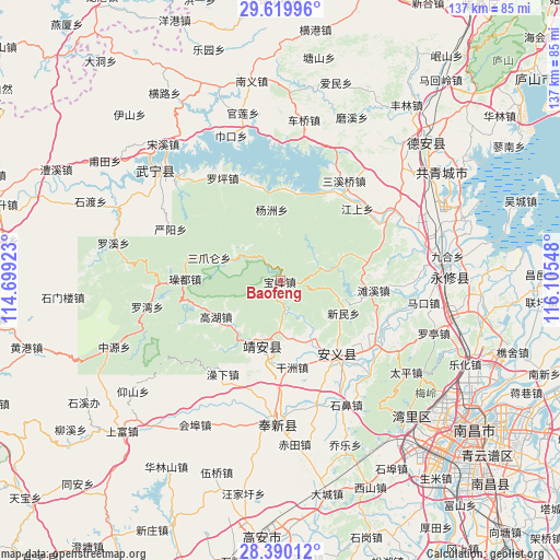
Baofeng GPS coordinates[2]
29° 0' 24.732" North, 115° 24' 8.46" East
| Map corner | latitude | longitude |
|---|---|---|
| Upper-left | 29.61996°, | 114.69923° |
| Center: | 29.00687°, | 115.40235° |
| Lower-right: | 28.39012°, | 116.10548° |
| Map W x H: | 136.7×136.7 km | = 84.9×84.9mi |
| max Lat: | 53.31946° ⇑65.4% North |
| Baofeng: | 29.00687° |
| min Lat: | ⇓34.6% South 18.22056° |
| min Long | Baofeng | max Long |
| 75.07348° | 115.40235° | 134.28917° |
| W 56.4%⇐ | ⇒43.6% E |
Elevation
Elevation of Baofeng is 124 m = 407 ft, and this is 360.8 m = 1184 ft below average elevation for this country.
| Max E: |
5622 m = 18445 ft | 56% |
| Avg. | 484.8 m = 1591 ft | |
| Baofeng | 124 m = 407 ft | |
Min E: |
-3 m = -10 ft | 44% |
See also: China elevation on elevation.city.
Geographical zone
Baofeng is located in North temperate zone (between Tropic of Cancer and the Arctic Circle). Distance of this Northern Tropic circle is 619.3 km =384.8 mi to South.| Distance of | km | miles | from Baofeng |
|---|---|---|---|
| North Pole | 6781.8 | 4214 | to North |
| Arctic Circle | 4175.9 | 2594.8 | to North |
| Tropic Cancer | 619.3 | 384.8 | to South |
| Equator | 3225.3 | 2004.1 | to South |


Nearby cities:
15 places around Baofeng: (largest is in red/bold)
• Baicha
27.4 km =17 mi,  44°
44°
• Cengjia
17.5 km =10.9 mi,  274°
274°
• Dinghu
23.4 km =14.5 mi,  143°
143°
• Ganzhou
21.2 km =13.2 mi,  171°
171°
• Gaohu
18.5 km =11.5 mi,  240°
240°
• Jiangshang
25.6 km =15.9 mi,  46°
46°
• Leigongjian
14.7 km =9.1 mi,  204°
204°
• Sanzhaolun
18.7 km =11.6 mi,  289°
289°
• Shuangxi
16.7 km =10.4 mi, 197°
• Shuikou
17.3 km =10.7 mi,  219°
219°
• Tanxi
22.7 km =14.1 mi,  96°
96°
• Xinminxiang
17.2 km =10.7 mi,  118°
118°
• Yangzhou
17.5 km =10.9 mi,  352°
352°
• Zhelin
24.7 km =15.3 mi,  24°
24°
• Zhelin
25.9 km =16.1 mi,  13°
13°
Sources, notices
• [Note1] Compared only with cities in China existing in our database
• [Src1] Map data: © OpenStreetMap contributors (CC-BY-SA)
• [Src2] Other city data from geonames.org with taken over terms of usage.
• [Src3] Geographical zone / Annual Mean Temperature by Robert A. Rohde @ Wikipedia
