Futianhe geodata
Futianhe (Hubei) is a seat of a fourth-order administrative division; located in China in Asia/Shanghai (GMT+8) time zone. In our database, there are 1268 cities with bigger population. Compared to other cities in China, 58.2% of cities are located further ↓South; 54.8% of cities are located further ←West and 55.7% of cities have higher elevation than Futianhe. Note1


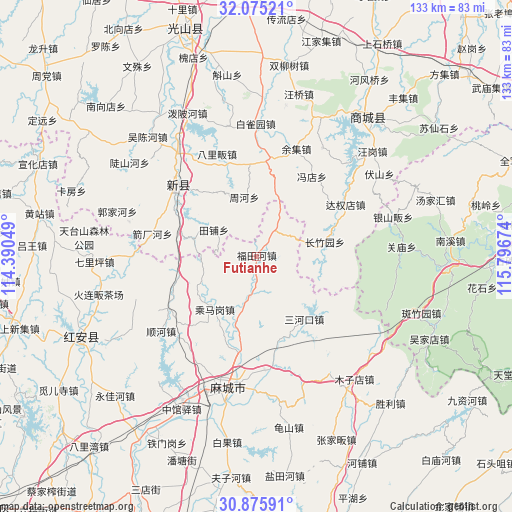
Futianhe GPS coordinates[2]
31° 28' 38.928" North, 115° 5' 36.996" East
| Map corner | latitude | longitude |
|---|---|---|
| Upper-left | 32.07521°, | 114.39049° |
| Center: | 31.47748°, | 115.09361° |
| Lower-right: | 30.87591°, | 115.79674° |
| Map W x H: | 133.3×133.4 km | = 82.8×82.9mi |
| max Lat: | 53.31946° ⇑41.8% North |
| Futianhe: | 31.47748° |
| min Lat: | ⇓58.2% South 18.22056° |
| min Long | Futianhe | max Long |
| 75.07348° | 115.09361° | 134.28917° |
| W 54.8%⇐ | ⇒45.2% E |
Elevation
Elevation of Futianhe is 126 m = 413 ft, and this is 358.8 m = 1177 ft below average elevation for this country.
| Max E: |
5622 m = 18445 ft | 55.7% |
| Avg. | 484.8 m = 1591 ft | |
| Futianhe | 126 m = 413 ft | |
Min E: |
-3 m = -10 ft | 44.3% |
See also: China elevation on elevation.city.
Geographical zone
Futianhe is located in North temperate zone (between Tropic of Cancer and the Arctic Circle). Distance of this Northern Tropic circle is 894 km =555.5 mi to South.| Distance of | km | miles | from Futianhe |
|---|---|---|---|
| North Pole | 6507.1 | 4043.3 | to North |
| Arctic Circle | 3901.2 | 2424.1 | to North |
| Tropic Cancer | 894 | 555.5 | to South |
| Equator | 3500 | 2174.8 | to South |


Nearby cities:
15 places around Futianhe: (largest is in red/bold)
• Chengmagang
17.6 km =10.9 mi,  217°
217°
• Gulou
33.7 km =20.9 mi,  189°
189°
• Hong’an Chengguanzhen
45.2 km =28.1 mi,  253°
253°
• Huangtugang
10.5 km =6.5 mi, 189°
• Longchiqiao
32.9 km =20.4 mi, 191°
• Macheng
33.8 km =21 mi, 191°
• Muzidian
40.7 km =25.3 mi,  141°
141°
• Nanhu
35.5 km =22.1 mi, 194°
• Qiliping
42.2 km =26.2 mi,  268°
268°
• Sanhekou
20.6 km =12.8 mi, 142°
• Shunhe
31.9 km =19.8 mi,  232°
232°
• Xinji
26.4 km =16.4 mi,  307°
307°
• Xiyang
38.3 km =23.8 mi, 215°
• Yanjiahe
29.8 km =18.5 mi,  175°
175°
• Zhongguanyi
44.3 km =27.5 mi,  206°
206°
Sources, notices
• [Note1] Compared only with cities in China existing in our database
• [Src1] Map data: © OpenStreetMap contributors (CC-BY-SA)
• [Src2] Other city data from geonames.org with taken over terms of usage.
• [Src3] Geographical zone / Annual Mean Temperature by Robert A. Rohde @ Wikipedia
