Fasi geodata
Fasi (Hubei) is a seat of a fourth-order administrative division; located in China in Asia/Shanghai (GMT+8) time zone. In our database, there are 1268 cities with bigger population. Compared to other cities in China, 52.5% of cities are located further ↑North; 50.4% of cities are located further →East and 76.7% of cities have higher elevation than Fasi. Note1


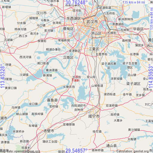
Fasi GPS coordinates[2]
30° 9' 23.04" North, 114° 9' 23.04" East
| Map corner | latitude | longitude |
|---|---|---|
| Upper-left | 30.76248°, | 113.45328° |
| Center: | 30.1564°, | 114.1564° |
| Lower-right: | 29.54657°, | 114.85953° |
| Map W x H: | 135.2×135.2 km | = 84×84mi |
| max Lat: | 53.31946° ⇑52.5% North |
| Fasi: | 30.1564° |
| min Lat: | ⇓47.5% South 18.22056° |
| min Long | Fasi | max Long |
| 75.07348° | 114.1564° | 134.28917° |
| W 49.6%⇐ | ⇒50.4% E |
Elevation
Elevation of Fasi is 33 m = 108 ft, and this is 451.8 m = 1482 ft below average elevation for this country.
| Max E: |
5622 m = 18445 ft | 76.7% |
| Avg. | 484.8 m = 1591 ft | |
| Fasi | 33 m = 108 ft | |
Min E: |
-3 m = -10 ft | 23.3% |
See also: China elevation on elevation.city.
Geographical zone
Fasi is located in North temperate zone (between Tropic of Cancer and the Arctic Circle). Distance of this Northern Tropic circle is 747.2 km =464.3 mi to South.| Distance of | km | miles | from Fasi |
|---|---|---|---|
| North Pole | 6654 | 4134.6 | to North |
| Arctic Circle | 4048.1 | 2515.4 | to North |
| Tropic Cancer | 747.2 | 464.3 | to South |
| Equator | 3353.1 | 2083.5 | to South |


Nearby cities:
15 places around Fasi: (largest is in red/bold)
• Dengnan
23.7 km =14.7 mi,  313°
313°
• Dongchengyuan
31.8 km =19.8 mi, 311°
• Henggouqiao
31.5 km =19.6 mi,  142°
142°
• Jinkou
20.6 km =12.8 mi,  352°
352°
• Junshan
28.5 km =17.7 mi, 345°
• Niaojin
23.6 km =14.7 mi,  334°
334°
• Paizhou
22.7 km =14.1 mi,  285°
285°
• Shenshan
31.4 km =19.5 mi,  203°
203°
• Wulijie
30.4 km =18.9 mi,  48°
48°
• Xiangyanghu
27.9 km =17.3 mi,  178°
178°
• Xinjie
22.5 km =14 mi,  225°
225°
• Xintan
25.8 km =16 mi,  273°
273°
• Yuyue
24.1 km =15 mi, 230°
• Zhengdian
21.6 km =13.4 mi,  24°
24°
• Zhifang
26.5 km =16.5 mi,  35°
35°
Sources, notices
• [Note1] Compared only with cities in China existing in our database
• [Src1] Map data: © OpenStreetMap contributors (CC-BY-SA)
• [Src2] Other city data from geonames.org with taken over terms of usage.
• [Src3] Geographical zone / Annual Mean Temperature by Robert A. Rohde @ Wikipedia
