Yuyue geodata
Yuyue (Hubei) is a seat of a third-order administrative division; located in China in Asia/Shanghai (GMT+8) time zone. In our database, there are 1268 cities with bigger population. Compared to other cities in China, 53.8% of cities are located further ↑North; 51.6% of cities are located further →East and 81.2% of cities have higher elevation than Yuyue. Note1


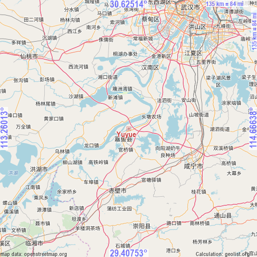
Yuyue GPS coordinates[2]
30° 1' 5.52" North, 113° 57' 47.7" East
| Map corner | latitude | longitude |
|---|---|---|
| Upper-left | 30.62514°, | 113.26013° |
| Center: | 30.0182°, | 113.96325° |
| Lower-right: | 29.40753°, | 114.66638° |
| Map W x H: | 135.4×135.4 km | = 84.1×84.1mi |
| max Lat: | 53.31946° ⇑53.8% North |
| Yuyue: | 30.0182° |
| min Lat: | ⇓46.2% South 18.22056° |
| min Long | Yuyue | max Long |
| 75.07348° | 113.96325° | 134.28917° |
| W 48.4%⇐ | ⇒51.6% E |
Elevation
Elevation of Yuyue is 24 m = 79 ft, and this is 460.8 m = 1512 ft below average elevation for this country.
| Max E: |
5622 m = 18445 ft | 81.2% |
| Avg. | 484.8 m = 1591 ft | |
| Yuyue | 24 m = 79 ft | |
Min E: |
-3 m = -10 ft | 18.8% |
See also: China elevation on elevation.city.
Geographical zone
Yuyue is located in North temperate zone (between Tropic of Cancer and the Arctic Circle). Distance of this Northern Tropic circle is 731.8 km =454.7 mi to South.| Distance of | km | miles | from Yuyue |
|---|---|---|---|
| North Pole | 6669.4 | 4144.2 | to North |
| Arctic Circle | 4063.5 | 2524.9 | to North |
| Tropic Cancer | 731.8 | 454.7 | to South |
| Equator | 3337.7 | 2073.9 | to South |


Nearby cities:
15 places around Yuyue: (largest is in red/bold)
• Fasi
24.1 km =15 mi,  50°
50°
• Gaotieling
23.9 km =14.9 mi,  223°
223°
• Guanqiao
10.9 km =6.8 mi,  190°
190°
• Guantangyi
29.4 km =18.3 mi,  156°
156°
• Hannan
29.8 km =18.5 mi,  337°
337°
• Longkou
21.5 km =13.4 mi,  246°
246°
• Luxi
29.6 km =18.4 mi, 247°
• Paizhou
21.5 km =13.4 mi,  350°
350°
• Shenshan
14.7 km =9.1 mi, 155°
• Tingsiqiao
29.8 km =18.5 mi,  138°
138°
• Xiangyanghu
23 km =14.3 mi,  122°
122°
• Xinjie
2.7 km =1.7 mi,  100°
100°
• Xintan
18.2 km =11.3 mi, 336°
• Yinlianhu
30.9 km =19.2 mi,  323°
323°
• Zhonghuopu
28.9 km =18 mi,  172°
172°
Sources, notices
• [Note1] Compared only with cities in China existing in our database
• [Src1] Map data: © OpenStreetMap contributors (CC-BY-SA)
• [Src2] Other city data from geonames.org with taken over terms of usage.
• [Src3] Geographical zone / Annual Mean Temperature by Robert A. Rohde @ Wikipedia
