Dongchuan geodata
Dongchuan (Qinghai) is a seat of a fourth-order administrative division; located in China in Asia/Shanghai (GMT+8) time zone. In our database, there are 1268 cities with bigger population. Compared to other cities in China, 79.9% of cities are located further ↓South; 93.1% of cities are located further →East and 97% of cities have lower elevation than Dongchuan. Note1


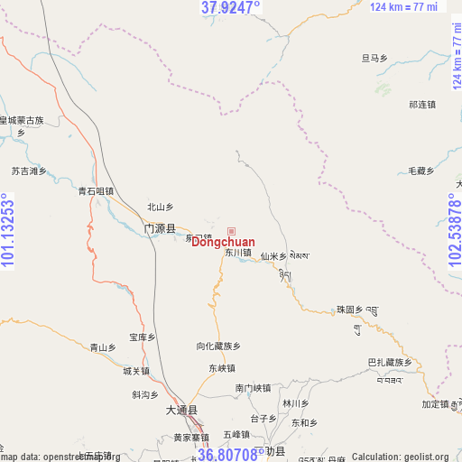
Dongchuan GPS coordinates[2]
37° 22' 4.692" North, 101° 50' 8.34" East
| Map corner | latitude | longitude |
|---|---|---|
| Upper-left | 37.9247°, | 101.13253° |
| Center: | 37.36797°, | 101.83565° |
| Lower-right: | 36.80708°, | 102.53878° |
| Map W x H: | 124.3×124.3 km | = 77.2×77.2mi |
| max Lat: | 53.31946° ⇑20.1% North |
| Dongchuan: | 37.36797° |
| min Lat: | ⇓79.9% South 18.22056° |
| min Long | Dongchuan | max Long |
| 75.07348° | 101.83565° | 134.28917° |
| W 6.9%⇐ | ⇒93.1% E |
Elevation
Elevation of Dongchuan is 3067 m = 10062 ft, and this is 2582.2 m = 8472 ft above average elevation for this country.
| Max E: |
5622 m = 18445 ft | 3% |
| Dongchuan | 3067 m 10062 ft | |
| Avg. | 484.8 m = 1591 ft | |
Min E: |
-3 m = -10 ft | 97% |
See also: China elevation on elevation.city.
Geographical zone
Dongchuan is located in North temperate zone (between Tropic of Cancer and the Arctic Circle). Distance of this Northern Tropic circle is 1549 km =962.5 mi to South.| Distance of | km | miles | from Dongchuan |
|---|---|---|---|
| North Pole | 5852.1 | 3636.3 | to North |
| Arctic Circle | 3246.2 | 2017.1 | to North |
| Tropic Cancer | 1549 | 962.5 | to South |
| Equator | 4154.9 | 2581.7 | to South |


Nearby cities:
15 places around Dongchuan: (largest is in red/bold)
• Beitan
59.8 km =37.2 mi,  358°
358°
• Changning
60.5 km =37.6 mi,  188°
188°
• Dongtan
54.9 km =34.1 mi, 357°
• Dongxia
36.9 km =22.9 mi, 186°
• Duolin
47.1 km =29.3 mi,  225°
225°
• Huangcheng
62.1 km =38.6 mi,  295°
295°
• Huangjiazhai
56.7 km =35.2 mi, 191°
• Jingyang
63.4 km =39.4 mi, 194°
• Nanmenxia
42.4 km =26.3 mi,  171°
171°
• Qiaotou
50.2 km =31.2 mi,  196°
196°
• Qingshizui
37.2 km =23.1 mi,  287°
287°
• Sujitan
58.7 km =36.5 mi, 286°
• Weiyuan
58.9 km =36.6 mi, 166°
• Wufeng
55.2 km =34.3 mi,  178°
178°
• Xinzhuang
41.9 km =26 mi,  215°
215°
Sources, notices
• [Note1] Compared only with cities in China existing in our database
• [Src1] Map data: © OpenStreetMap contributors (CC-BY-SA)
• [Src2] Other city data from geonames.org with taken over terms of usage.
• [Src3] Geographical zone / Annual Mean Temperature by Robert A. Rohde @ Wikipedia
