Huangcheng geodata
Huangcheng (Qinghai) is a seat of a fourth-order administrative division; located in China in Asia/Shanghai (GMT+8) time zone. In our database, there are 1268 cities with bigger population. Compared to other cities in China, 80.4% of cities are located further ↓South; 93.6% of cities are located further →East and 97.1% of cities have lower elevation than Huangcheng. Note1


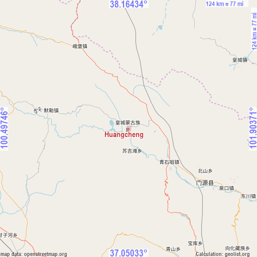
Huangcheng GPS coordinates[2]
37° 36' 33.912" North, 101° 12' 2.088" East
| Map corner | latitude | longitude |
|---|---|---|
| Upper-left | 38.16434°, | 100.49746° |
| Center: | 37.60942°, | 101.20058° |
| Lower-right: | 37.05033°, | 101.90371° |
| Map W x H: | 123.9×123.9 km | = 77×77mi |
| max Lat: | 53.31946° ⇑19.6% North |
| Huangcheng: | 37.60942° |
| min Lat: | ⇓80.4% South 18.22056° |
| min Long | Huangcheng | max Long |
| 75.07348° | 101.20058° | 134.28917° |
| W 6.4%⇐ | ⇒93.6% E |
Elevation
Elevation of Huangcheng is 3131 m = 10272 ft, and this is 2646.2 m = 8682 ft above average elevation for this country.
| Max E: |
5622 m = 18445 ft | 2.9% |
| Huangcheng | 3131 m 10272 ft | |
| Avg. | 484.8 m = 1591 ft | |
Min E: |
-3 m = -10 ft | 97.1% |
See also: China elevation on elevation.city.
Geographical zone
Huangcheng is located in North temperate zone (between Tropic of Cancer and the Arctic Circle). Distance of this Northern Tropic circle is 1575.9 km =979.2 mi to South.| Distance of | km | miles | from Huangcheng |
|---|---|---|---|
| North Pole | 5825.3 | 3619.7 | to North |
| Arctic Circle | 3219.4 | 2000.4 | to North |
| Tropic Cancer | 1575.9 | 979.2 | to South |
| Equator | 4181.8 | 2598.4 | to South |


Nearby cities:
15 places around Huangcheng: (largest is in red/bold)
• Beitan
63.8 km =39.6 mi,  58°
58°
• Dongchuan
62.1 km =38.6 mi,  115°
115°
• Dongtan
60.2 km =37.4 mi, 62°
• Duolin
63.9 km =39.7 mi,  159°
159°
• Hairag
81.5 km =50.6 mi,  238°
238°
• Hongtu
46.3 km =28.8 mi,  329°
329°
• Maying
61 km =37.9 mi,  47°
47°
• Muri
42.7 km =26.5 mi,  282°
282°
• Obo
46 km =28.6 mi, 329°
• Qingshizui
25.9 km =16.1 mi,  127°
127°
• Sujitan
9.8 km =6.1 mi,  180°
180°
• Tuohua
74.4 km =46.2 mi,  217°
217°
• Xinchengzi
72.8 km =45.2 mi,  28°
28°
• Xinzhuang
68.7 km =42.7 mi,  152°
152°
• Yangxiang
81.4 km =50.6 mi, 58°
Sources, notices
• [Note1] Compared only with cities in China existing in our database
• [Src1] Map data: © OpenStreetMap contributors (CC-BY-SA)
• [Src2] Other city data from geonames.org with taken over terms of usage.
• [Src3] Geographical zone / Annual Mean Temperature by Robert A. Rohde @ Wikipedia
