Dianfang geodata
Dianfang (Hunan) is a seat of a fourth-order administrative division; located in China in Asia/Shanghai (GMT+8) time zone. In our database, there are 1268 cities with bigger population. Compared to other cities in China, 65.7% of cities are located further ↑North; 73.5% of cities are located further →East and 63.6% of cities have lower elevation than Dianfang. Note1


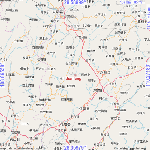
Dianfang GPS coordinates[2]
28° 58' 36.192" North, 109° 34' 7.32" East
| Map corner | latitude | longitude |
|---|---|---|
| Upper-left | 29.58999°, | 108.86558° |
| Center: | 28.97672°, | 109.5687° |
| Lower-right: | 28.35979°, | 110.27183° |
| Map W x H: | 136.8×136.8 km | = 85×85mi |
| max Lat: | 53.31946° ⇑65.7% North |
| Dianfang: | 28.97672° |
| min Lat: | ⇓34.3% South 18.22056° |
| min Long | Dianfang | max Long |
| 75.07348° | 109.5687° | 134.28917° |
| W 26.5%⇐ | ⇒73.5% E |
Elevation
Elevation of Dianfang is 306 m = 1004 ft, and this is 178.8 m = 587 ft below average elevation for this country.
| Max E: |
5622 m = 18445 ft | 36.4% |
| Avg. | 484.8 m = 1591 ft | |
| Dianfang | 306 m = 1004 ft | |
Min E: |
-3 m = -10 ft | 63.6% |
See also: China elevation on elevation.city.
Geographical zone
Dianfang is located in North temperate zone (between Tropic of Cancer and the Arctic Circle). Distance of this Northern Tropic circle is 616 km =382.8 mi to South.| Distance of | km | miles | from Dianfang |
|---|---|---|---|
| North Pole | 6785.2 | 4216.1 | to North |
| Arctic Circle | 4179.3 | 2596.9 | to North |
| Tropic Cancer | 616 | 382.8 | to South |
| Equator | 3221.9 | 2002 | to South |


Nearby cities:
15 places around Dianfang: (largest is in red/bold)
• Duishan
11.4 km =7.1 mi,  129°
129°
• Fengxizhai
12.4 km =7.7 mi,  285°
285°
• Heping
16.3 km =10.1 mi,  106°
106°
• Jiashi
16.2 km =10.1 mi,  267°
267°
• Longtou
17 km =10.6 mi,  226°
226°
• Mengxihu
18.4 km =11.4 mi,  331°
331°
• Miao’ertan
9.8 km =6.1 mi,  252°
252°
• Pojiao
10.3 km =6.4 mi,  200°
200°
• Purong
13.9 km =8.6 mi,  160°
160°
• Shaoha
20.1 km =12.5 mi,  75°
75°
• Tasha
9 km =5.6 mi,  358°
358°
• Xichehe
11 km =6.8 mi,  341°
341°
• Xiqi
9.5 km =5.9 mi,  86°
86°
• Xishaping
18.9 km =11.7 mi,  347°
347°
• Zanguoping
22.1 km =13.7 mi,  284°
284°
Sources, notices
• [Note1] Compared only with cities in China existing in our database
• [Src1] Map data: © OpenStreetMap contributors (CC-BY-SA)
• [Src2] Other city data from geonames.org with taken over terms of usage.
• [Src3] Geographical zone / Annual Mean Temperature by Robert A. Rohde @ Wikipedia
