Meisha geodata
Meisha (Guangdong) is a seat of a fourth-order administrative division; located in China in Asia/Shanghai (GMT+8) time zone. In our database, there are 1268 cities with bigger population. Compared to other cities in China, 96% of cities are located further ↑North; 50.4% of cities are located further ←West and 92.7% of cities have higher elevation than Meisha. Note1


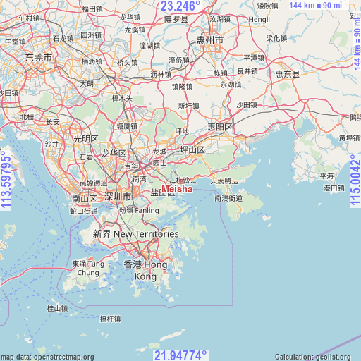
Meisha GPS coordinates[2]
22° 35' 54.24" North, 114° 18' 3.852" East
| Map corner | latitude | longitude |
|---|---|---|
| Upper-left | 23.246°, | 113.59795° |
| Center: | 22.5984°, | 114.30107° |
| Lower-right: | 21.94774°, | 115.0042° |
| Map W x H: | 144.4×144.4 km | = 89.7×89.7mi |
| max Lat: | 53.31946° ⇑96% North |
| Meisha: | 22.5984° |
| min Lat: | ⇓4% South 18.22056° |
| min Long | Meisha | max Long |
| 75.07348° | 114.30107° | 134.28917° |
| W 50.4%⇐ | ⇒49.6% E |
Elevation
Elevation of Meisha is 8 m = 26 ft, and this is 476.8 m = 1564 ft below average elevation for this country.
| Max E: |
5622 m = 18445 ft | 92.7% |
| Avg. | 484.8 m = 1591 ft | |
| Meisha | 8 m = 26 ft | |
Min E: |
-3 m = -10 ft | 7.3% |
See also: China elevation on elevation.city.
Geographical zone
Meisha is located in North Torrid zone (between Equator and Tropic of Cancer). Distance of this Northern Tropic circle is 93.2 km =57.9 mi to North.| Distance of | km | miles | from Meisha |
|---|---|---|---|
| North Pole | 7494.4 | 4656.8 | to North |
| Arctic Circle | 4888.5 | 3037.6 | to North |
| Tropic Cancer | 93.2 | 57.9 | to North |
| Equator | 2512.7 | 1561.3 | to South |


Nearby cities:
15 places around Meisha: (largest is in red/bold)
• Buji
20.6 km =12.8 mi,  271°
271°
• Dapeng
17.7 km =11 mi,  89°
89°
• Haishan
10.2 km =6.3 mi,  243°
243°
• Henggang
12.1 km =7.5 mi,  297°
297°
• Kengzi
18.5 km =11.5 mi,  22°
22°
• Kuiyong
12.6 km =7.8 mi,  69°
69°
• Liantang
14.1 km =8.8 mi,  255°
255°
• Longcheng
14.5 km =9 mi,  322°
322°
• Longgang
14.4 km =8.9 mi,  344°
344°
• Nanwan
17.5 km =10.9 mi, 270°
• Nan’ao
20.4 km =12.7 mi,  108°
108°
• Pingdi
19.2 km =11.9 mi,  0°
0°
• Pingshan
11.2 km =7 mi, 17°
• Shatoujiao
9.1 km =5.7 mi, 237°
• Yantian
8 km =5 mi, 237°
Sources, notices
• [Note1] Compared only with cities in China existing in our database
• [Src1] Map data: © OpenStreetMap contributors (CC-BY-SA)
• [Src2] Other city data from geonames.org with taken over terms of usage.
• [Src3] Geographical zone / Annual Mean Temperature by Robert A. Rohde @ Wikipedia
