Chengxi geodata
Chengxi (Chongqing) is a seat of a fourth-order administrative division; located in China in Asia/Shanghai (GMT+8) time zone. In our database, there are 1268 cities with bigger population. Compared to other cities in China, 52% of cities are located further ↑North; 82.9% of cities are located further →East and 69.8% of cities have lower elevation than Chengxi. Note1


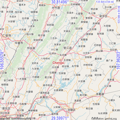
Chengxi GPS coordinates[2]
30° 12' 33.156" North, 107° 15' 32.04" East
| Map corner | latitude | longitude |
|---|---|---|
| Upper-left | 30.81496°, | 106.55578° |
| Center: | 30.20921°, | 107.2589° |
| Lower-right: | 29.59971°, | 107.96203° |
| Map W x H: | 135.1×135.1 km | = 83.9×83.9mi |
| max Lat: | 53.31946° ⇑52% North |
| Chengxi: | 30.20921° |
| min Lat: | ⇓48% South 18.22056° |
| min Long | Chengxi | max Long |
| 75.07348° | 107.2589° | 134.28917° |
| W 17.1%⇐ | ⇒82.9% E |
Elevation
Elevation of Chengxi is 408 m = 1339 ft, and this is 76.8 m = 252 ft below average elevation for this country.
| Max E: |
5622 m = 18445 ft | 30.2% |
| Avg. | 484.8 m = 1591 ft | |
| Chengxi | 408 m = 1339 ft | |
Min E: |
-3 m = -10 ft | 69.8% |
See also: China elevation on elevation.city.
Geographical zone
Chengxi is located in North temperate zone (between Tropic of Cancer and the Arctic Circle). Distance of this Northern Tropic circle is 753 km =467.9 mi to South.| Distance of | km | miles | from Chengxi |
|---|---|---|---|
| North Pole | 6648.1 | 4130.9 | to North |
| Arctic Circle | 4042.2 | 2511.7 | to North |
| Tropic Cancer | 753 | 467.9 | to South |
| Equator | 3358.9 | 2087.1 | to South |


Nearby cities:
15 places around Chengxi: (largest is in red/bold)
• Baijia
22.3 km =13.9 mi,  163°
163°
• Baojia
14.9 km =9.3 mi,  170°
170°
• Changlong
18.3 km =11.4 mi,  53°
53°
• Gaofeng
14.4 km =8.9 mi,  85°
85°
• Gao’an
21.5 km =13.4 mi,  65°
65°
• Guixi
16.1 km =10 mi,  31°
31°
• Haitang
5 km =3.1 mi,  213°
213°
• Heyou
16.7 km =10.4 mi,  147°
147°
• Huangsha
12.8 km =8 mi,  61°
61°
• Pingshan
20.3 km =12.6 mi,  128°
128°
• Shiyan
16.3 km =10.1 mi, 210°
• Taiping
6.7 km =4.2 mi, 29°
• Wudong
7.9 km =4.9 mi, 89°
• Yantai
9.1 km =5.7 mi,  139°
139°
• Yuntai
9.4 km =5.8 mi, 213°
Sources, notices
• [Note1] Compared only with cities in China existing in our database
• [Src1] Map data: © OpenStreetMap contributors (CC-BY-SA)
• [Src2] Other city data from geonames.org with taken over terms of usage.
• [Src3] Geographical zone / Annual Mean Temperature by Robert A. Rohde @ Wikipedia
