Huangsha geodata
Huangsha (Chongqing) is a seat of a fourth-order administrative division; located in China in Asia/Shanghai (GMT+8) time zone. In our database, there are 1268 cities with bigger population. Compared to other cities in China, 51.6% of cities are located further ↑North; 82.6% of cities are located further →East and 73.2% of cities have lower elevation than Huangsha. Note1


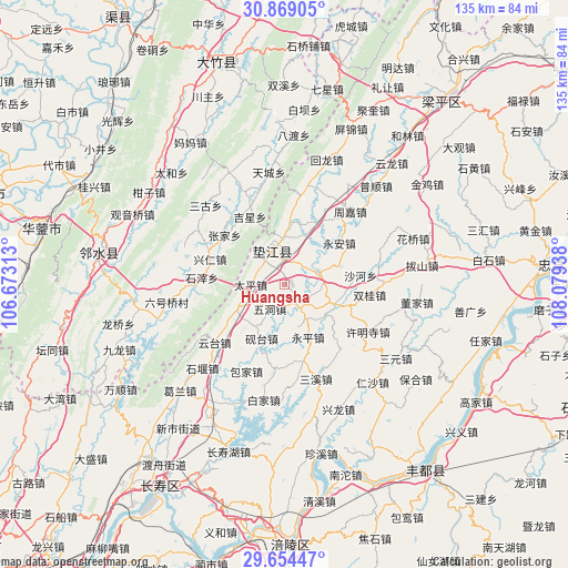
Huangsha GPS coordinates[2]
30° 15' 49.104" North, 107° 22' 34.5" East
| Map corner | latitude | longitude |
|---|---|---|
| Upper-left | 30.86905°, | 106.67313° |
| Center: | 30.26364°, | 107.37625° |
| Lower-right: | 29.65447°, | 108.07938° |
| Map W x H: | 135×135 km | = 83.9×83.9mi |
| max Lat: | 53.31946° ⇑51.6% North |
| Huangsha: | 30.26364° |
| min Lat: | ⇓48.4% South 18.22056° |
| min Long | Huangsha | max Long |
| 75.07348° | 107.37625° | 134.28917° |
| W 17.4%⇐ | ⇒82.6% E |
Elevation
Elevation of Huangsha is 479 m = 1572 ft, and this is 5.8 m = 19 ft below average elevation for this country.
| Max E: |
5622 m = 18445 ft | 26.8% |
| Avg. | 484.8 m = 1591 ft | |
| Huangsha | 479 m = 1572 ft | |
Min E: |
-3 m = -10 ft | 73.2% |
See also: China elevation on elevation.city.
Geographical zone
Huangsha is located in North temperate zone (between Tropic of Cancer and the Arctic Circle). Distance of this Northern Tropic circle is 759.1 km =471.7 mi to South.| Distance of | km | miles | from Huangsha |
|---|---|---|---|
| North Pole | 6642.1 | 4127.2 | to North |
| Arctic Circle | 4036.2 | 2508 | to North |
| Tropic Cancer | 759.1 | 471.7 | to South |
| Equator | 3365 | 2090.9 | to South |


Nearby cities:
15 places around Huangsha: (largest is in red/bold)
• Caohui
17.4 km =10.8 mi,  31°
31°
• Changlong
5.9 km =3.7 mi,  36°
36°
• Chengxi
12.8 km =8 mi,  241°
241°
• Dashi
16.9 km =10.5 mi,  114°
114°
• Gangjia
13.2 km =8.2 mi, 111°
• Gaofeng
5.8 km =3.6 mi,  148°
148°
• Gao’an
8.7 km =5.4 mi,  70°
70°
• Guixi
8.3 km =5.2 mi,  339°
339°
• Haitang
17.4 km =10.8 mi,  233°
233°
• Pingshan
19.1 km =11.9 mi,  166°
166°
• Taiping
8 km =5 mi,  268°
268°
• Wudong
6.9 km =4.3 mi,  209°
209°
• Xinmin
14.9 km =9.3 mi,  4°
4°
• Yantai
14.1 km =8.8 mi,  202°
202°
• Yong’an
16.5 km =10.3 mi,  52°
52°
Sources, notices
• [Note1] Compared only with cities in China existing in our database
• [Src1] Map data: © OpenStreetMap contributors (CC-BY-SA)
• [Src2] Other city data from geonames.org with taken over terms of usage.
• [Src3] Geographical zone / Annual Mean Temperature by Robert A. Rohde @ Wikipedia
