Changlong geodata
Changlong (Chongqing) is a seat of a fourth-order administrative division; located in China in Asia/Shanghai (GMT+8) time zone. In our database, there are 1268 cities with bigger population. Compared to other cities in China, 51.1% of cities are located further ↑North; 82.4% of cities are located further →East and 68.5% of cities have lower elevation than Changlong. Note1


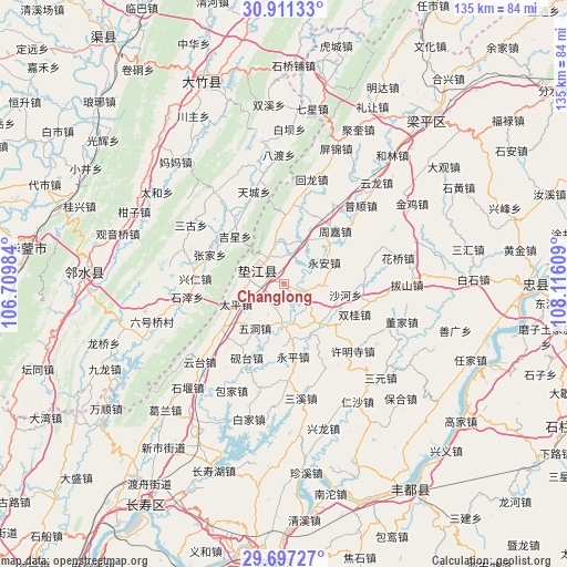
Changlong GPS coordinates[2]
30° 18' 22.248" North, 107° 24' 46.656" East
| Map corner | latitude | longitude |
|---|---|---|
| Upper-left | 30.91133°, | 106.70984° |
| Center: | 30.30618°, | 107.41296° |
| Lower-right: | 29.69727°, | 108.11609° |
| Map W x H: | 135×135 km | = 83.9×83.9mi |
| max Lat: | 53.31946° ⇑51.1% North |
| Changlong: | 30.30618° |
| min Lat: | ⇓48.9% South 18.22056° |
| min Long | Changlong | max Long |
| 75.07348° | 107.41296° | 134.28917° |
| W 17.6%⇐ | ⇒82.4% E |
Elevation
Elevation of Changlong is 386 m = 1266 ft, and this is 98.8 m = 324 ft below average elevation for this country.
| Max E: |
5622 m = 18445 ft | 31.5% |
| Avg. | 484.8 m = 1591 ft | |
| Changlong | 386 m = 1266 ft | |
Min E: |
-3 m = -10 ft | 68.5% |
See also: China elevation on elevation.city.
Geographical zone
Changlong is located in North temperate zone (between Tropic of Cancer and the Arctic Circle). Distance of this Northern Tropic circle is 763.8 km =474.6 mi to South.| Distance of | km | miles | from Changlong |
|---|---|---|---|
| North Pole | 6637.3 | 4124.2 | to North |
| Arctic Circle | 4031.4 | 2505 | to North |
| Tropic Cancer | 763.8 | 474.6 | to South |
| Equator | 3369.7 | 2093.8 | to South |


Nearby cities:
15 places around Changlong: (largest is in red/bold)
• Caohui
11.5 km =7.1 mi,  28°
28°
• Chengxi
18.3 km =11.4 mi,  233°
233°
• Dashi
16.8 km =10.4 mi,  135°
135°
• Gangjia
12.9 km =8 mi, 137°
• Gaofeng
9.6 km =6 mi,  182°
182°
• Gao’an
5 km =3.1 mi,  110°
110°
• Guixi
7.2 km =4.5 mi,  295°
295°
• Huangsha
5.9 km =3.7 mi,  216°
216°
• Shaping
18.9 km =11.7 mi,  6°
6°
• Shuanggui
18.2 km =11.3 mi, 112°
• Taiping
12.5 km =7.8 mi,  246°
246°
• Wudong
12.7 km =7.9 mi,  212°
212°
• Xinmin
10.4 km =6.5 mi,  347°
347°
• Yong’an
10.9 km =6.8 mi,  61°
61°
• Zhoujia
17.4 km =10.8 mi,  43°
43°
Sources, notices
• [Note1] Compared only with cities in China existing in our database
• [Src1] Map data: © OpenStreetMap contributors (CC-BY-SA)
• [Src2] Other city data from geonames.org with taken over terms of usage.
• [Src3] Geographical zone / Annual Mean Temperature by Robert A. Rohde @ Wikipedia
