Jiangyin geodata
Jiangyin (Jiangsu) is a seat of a third-order administrative division; located in China in Asia/Shanghai (GMT+8) time zone. With population of 107,918 people, there are 407 cities with bigger population in this country. Compared to other cities in China, 60.6% of cities are located further ↓South; 83.7% of cities are located further ←West and 94.3% of cities have higher elevation than Jiangyin. Note1


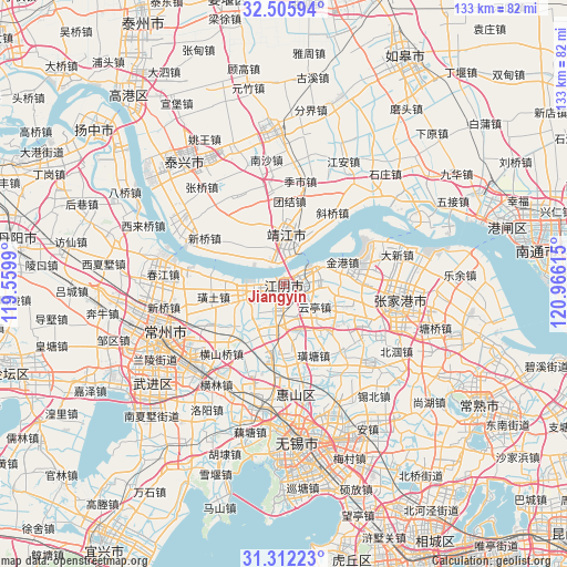
Jiangyin GPS coordinates[2]
31° 54' 39.672" North, 120° 15' 46.872" East
| Map corner | latitude | longitude |
|---|---|---|
| Upper-left | 32.50594°, | 119.5599° |
| Center: | 31.91102°, | 120.26302° |
| Lower-right: | 31.31223°, | 120.96615° |
| Map W x H: | 132.7×132.7 km | = 82.5×82.5mi |
| max Lat: | 53.31946° ⇑39.4% North |
| Jiangyin: | 31.91102° |
| min Lat: | ⇓60.6% South 18.22056° |
| min Long | Jiangyin | max Long |
| 75.07348° | 120.26302° | 134.28917° |
| W 83.7%⇐ | ⇒16.3% E |
Elevation
Elevation of Jiangyin is 7 m = 23 ft, and this is 477.8 m = 1568 ft below average elevation for this country.
| Max E: |
5622 m = 18445 ft | 94.3% |
| Avg. | 484.8 m = 1591 ft | |
| Jiangyin | 7 m = 23 ft | |
Min E: |
-3 m = -10 ft | 5.7% |
See also: Jiangyin elevation on elevation.city.
Geographical zone
Jiangyin is located in North temperate zone (between Tropic of Cancer and the Arctic Circle). Distance of this Northern Tropic circle is 942.3 km =585.5 mi to South.| Distance of | km | miles | from Jiangyin |
|---|---|---|---|
| North Pole | 6458.9 | 4013.4 | to North |
| Arctic Circle | 3853 | 2394.1 | to North |
| Tropic Cancer | 942.3 | 585.5 | to South |
| Equator | 3548.2 | 2204.7 | to South |


Nearby cities:
15 places around Jiangyin: (largest is in red/bold)
• Changdai
14.6 km =9.1 mi,  342°
342°
• Dongxing
12.5 km =7.8 mi,  309°
309°
• Jingang
13.9 km =8.6 mi,  69°
69°
• Jingjiang
11.5 km =7.1 mi,  359°
359°
• Ligang
17.5 km =10.9 mi,  275°
275°
• Nanzha
6.5 km =4 mi,  198°
198°
• Qingyang
16.2 km =10.1 mi,  183°
183°
• Shengang
12.1 km =7.5 mi,  257°
257°
• Shengci
16.8 km =10.4 mi,  326°
326°
• Xiagang
5.3 km =3.3 mi,  252°
252°
• Xishiqiao
17.1 km =10.6 mi, 254°
• Yaosai
1.9 km =1.2 mi,  109°
109°
• Yuecheng
11.2 km =7 mi,  191°
191°
• Yunting
8.7 km =5.4 mi,  126°
126°
• Zhouzhuang
14.1 km =8.8 mi, 110°
Sources, notices
• [Note1] Compared only with cities in China existing in our database
• [Src1] Map data: © OpenStreetMap contributors (CC-BY-SA)
• [Src2] Other city data from geonames.org with taken over terms of usage.
• [Src3] Geographical zone / Annual Mean Temperature by Robert A. Rohde @ Wikipedia
