Puxi geodata
Puxi (Henan) is a seat of a third-order administrative division; located in China in Asia/Shanghai (GMT+8) time zone. In our database, there are 1268 cities with bigger population. Compared to other cities in China, 75.4% of cities are located further ↓South; 52.5% of cities are located further ←West and 67.2% of cities have higher elevation than Puxi. Note1


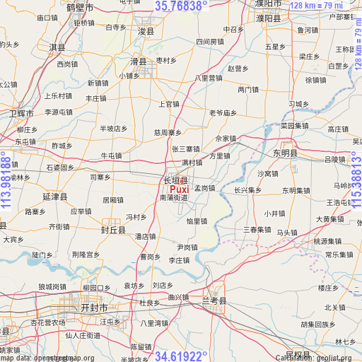
Puxi GPS coordinates[2]
35° 11' 44.988" North, 114° 41' 6" East
| Map corner | latitude | longitude |
|---|---|---|
| Upper-left | 35.76838°, | 113.98188° |
| Center: | 35.19583°, | 114.685° |
| Lower-right: | 34.61922°, | 115.38813° |
| Map W x H: | 127.8×127.8 km | = 79.4×79.4mi |
| max Lat: | 53.31946° ⇑24.6% North |
| Puxi: | 35.19583° |
| min Lat: | ⇓75.4% South 18.22056° |
| min Long | Puxi | max Long |
| 75.07348° | 114.685° | 134.28917° |
| W 52.5%⇐ | ⇒47.5% E |
Elevation
Elevation of Puxi is 64 m = 210 ft, and this is 420.8 m = 1381 ft below average elevation for this country.
| Max E: |
5622 m = 18445 ft | 67.2% |
| Avg. | 484.8 m = 1591 ft | |
| Puxi | 64 m = 210 ft | |
Min E: |
-3 m = -10 ft | 32.8% |
See also: China elevation on elevation.city.
Geographical zone
Puxi is located in North temperate zone (between Tropic of Cancer and the Arctic Circle). Distance of this Northern Tropic circle is 1307.5 km =812.4 mi to South.| Distance of | km | miles | from Puxi |
|---|---|---|---|
| North Pole | 6093.7 | 3786.4 | to North |
| Arctic Circle | 3487.8 | 2167.2 | to North |
| Tropic Cancer | 1307.5 | 812.4 | to South |
| Equator | 3913.4 | 2431.7 | to South |


Nearby cities:
15 places around Puxi: (largest is in red/bold)
• Changyuan County
4.9 km =3 mi,  67°
67°
• Chaoge
64 km =39.8 mi,  315°
315°
• Chengguan
41.4 km =25.7 mi, 72°
• Chengjiao
61.3 km =38.1 mi,  292°
292°
• Daokou
44 km =27.3 mi,  338°
338°
• Dongming Chengguanzhen
38.3 km =23.8 mi, 73°
• Fengqiu Chengguanzhen
30.9 km =19.2 mi,  233°
233°
• Kaifeng
56 km =34.8 mi,  217°
217°
• Lankao Chengguanzhen
41.9 km =26 mi,  164°
164°
• Puyang
69.9 km =43.4 mi,  25°
25°
• Puyang Chengguanzhen
64 km =39.8 mi, 27°
• Xicheng
68.2 km =42.4 mi,  85°
85°
• Xun Xian Chengguanzhen
53.9 km =33.5 mi,  345°
345°
• Yanjin Chengguanzhen
45.6 km =28.3 mi,  262°
262°
• Yuanyang Chengguanzhen
67.5 km =41.9 mi, 256°
Sources, notices
• [Note1] Compared only with cities in China existing in our database
• [Src1] Map data: © OpenStreetMap contributors (CC-BY-SA)
• [Src2] Other city data from geonames.org with taken over terms of usage.
• [Src3] Geographical zone / Annual Mean Temperature by Robert A. Rohde @ Wikipedia
