Changyuan County geodata
Changyuan County (Henan) is a seat of a third-order administrative division; located in China in Asia/Shanghai (GMT+8) time zone. In our database, there are 1268 cities with bigger population. Compared to other cities in China, 75.5% of cities are located further ↓South; 52.8% of cities are located further ←West and 67.4% of cities have higher elevation than Changyuan County. Note1


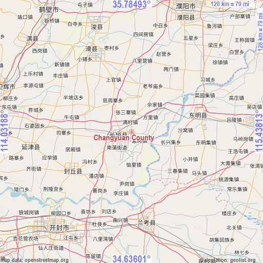
Changyuan County GPS coordinates[2]
35° 12' 45" North, 114° 44' 6" East
| Map corner | latitude | longitude |
|---|---|---|
| Upper-left | 35.78493°, | 114.03188° |
| Center: | 35.2125°, | 114.735° |
| Lower-right: | 34.63601°, | 115.43813° |
| Map W x H: | 127.7×127.7 km | = 79.3×79.3mi |
| max Lat: | 53.31946° ⇑24.5% North |
| Changyuan County: | 35.2125° |
| min Lat: | ⇓75.5% South 18.22056° |
| min Long | Changyuan Count | max Long |
| 75.07348° | 114.735° | 134.28917° |
| W 52.8%⇐ | ⇒47.2% E |
Elevation
Elevation of Changyuan County is 63 m = 207 ft, and this is 421.8 m = 1384 ft below average elevation for this country.
| Max E: |
5622 m = 18445 ft | 67.4% |
| Avg. | 484.8 m = 1591 ft | |
| Changyuan County | 63 m = 207 ft | |
Min E: |
-3 m = -10 ft | 32.6% |
See also: China elevation on elevation.city.
Geographical zone
Changyuan County is located in North temperate zone (between Tropic of Cancer and the Arctic Circle). Distance of this Northern Tropic circle is 1309.3 km =813.6 mi to South.| Distance of | km | miles | from Changyuan County |
|---|---|---|---|
| North Pole | 6091.8 | 3785.3 | to North |
| Arctic Circle | 3485.9 | 2166 | to North |
| Tropic Cancer | 1309.3 | 813.6 | to South |
| Equator | 3915.3 | 2432.9 | to South |


Nearby cities:
15 places around Changyuan County: (largest is in red/bold)
• Chaoge
66 km =41 mi,  311°
311°
• Chengguan
36.5 km =22.7 mi,  72°
72°
• Chengjiao
64.8 km =40.3 mi,  289°
289°
• Daokou
44.3 km =27.5 mi,  332°
332°
• Dongming Chengguanzhen
33.4 km =20.8 mi, 74°
• Fengqiu Chengguanzhen
35.7 km =22.2 mi,  235°
235°
• Heze
67.2 km =41.8 mi,  87°
87°
• Kaifeng
60.3 km =37.5 mi,  220°
220°
• Lankao Chengguanzhen
42.7 km =26.5 mi,  171°
171°
• Puxi
4.9 km =3 mi,  247°
247°
• Puyang
66.3 km =41.2 mi,  22°
22°
• Puyang Chengguanzhen
60.3 km =37.5 mi, 24°
• Xicheng
63.5 km =39.5 mi, 86°
• Xun Xian Chengguanzhen
53.5 km =33.2 mi,  340°
340°
• Yanjin Chengguanzhen
50.4 km =31.3 mi,  260°
260°
Sources, notices
• [Note1] Compared only with cities in China existing in our database
• [Src1] Map data: © OpenStreetMap contributors (CC-BY-SA)
• [Src2] Other city data from geonames.org with taken over terms of usage.
• [Src3] Geographical zone / Annual Mean Temperature by Robert A. Rohde @ Wikipedia
