Bencheng geodata
Bencheng (Hebei) is a seat of a third-order administrative division; located in China in Asia/Shanghai (GMT+8) time zone. In our database, there are 1268 cities with bigger population. Compared to other cities in China, 84.6% of cities are located further ↓South; 74.4% of cities are located further ←West and 85.5% of cities have higher elevation than Bencheng. Note1


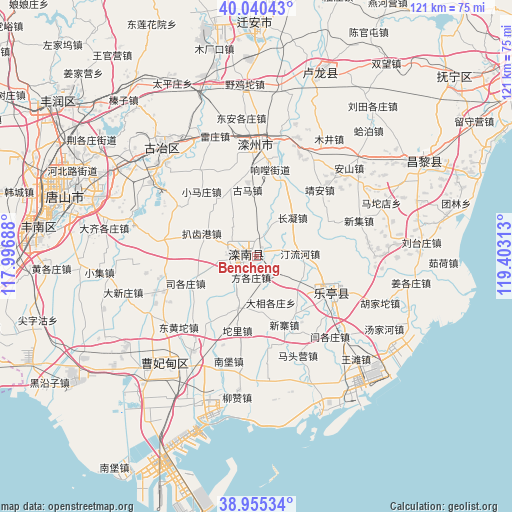
Bencheng GPS coordinates[2]
39° 30' 0" North, 118° 42' 0" East
| Map corner | latitude | longitude |
|---|---|---|
| Upper-left | 40.04043°, | 117.99688° |
| Center: | 39.5°, | 118.7° |
| Lower-right: | 38.95534°, | 119.40313° |
| Map W x H: | 120.7×120.7 km | = 75×75mi |
| max Lat: | 53.31946° ⇑15.4% North |
| Bencheng: | 39.5° |
| min Lat: | ⇓84.6% South 18.22056° |
| min Long | Bencheng | max Long |
| 75.07348° | 118.7° | 134.28917° |
| W 74.4%⇐ | ⇒25.6% E |
Elevation
Elevation of Bencheng is 15 m = 49 ft, and this is 469.8 m = 1541 ft below average elevation for this country.
| Max E: |
5622 m = 18445 ft | 85.5% |
| Avg. | 484.8 m = 1591 ft | |
| Bencheng | 15 m = 49 ft | |
Min E: |
-3 m = -10 ft | 14.5% |
See also: China elevation on elevation.city.
Geographical zone
Bencheng is located in North temperate zone (between Tropic of Cancer and the Arctic Circle). Distance of this Northern Tropic circle is 1786.1 km =1109.8 mi to South.| Distance of | km | miles | from Bencheng |
|---|---|---|---|
| North Pole | 5615.1 | 3489.1 | to North |
| Arctic Circle | 3009.2 | 1869.8 | to North |
| Tropic Cancer | 1786.1 | 1109.8 | to South |
| Equator | 4392 | 2729.1 | to South |


Nearby cities:
15 places around Bencheng: (largest is in red/bold)
• Beidaihe
76.6 km =47.6 mi,  61°
61°
• Changli
44.8 km =27.8 mi, 59°
• Dashentang
71.5 km =44.4 mi,  243°
243°
• Fengrun
62.2 km =38.6 mi,  306°
306°
• Fuzhuang
70.7 km =43.9 mi,  248°
248°
• Gaozhuang
67.3 km =41.8 mi, 247°
• Guye
33.9 km =21.1 mi,  319°
319°
• Kaiping
43.2 km =26.8 mi,  297°
297°
• Linxi
31.9 km =19.8 mi, 317°
• Luanzhou
27.9 km =17.3 mi,  5°
5°
• Penguanzhuang
76.1 km =47.3 mi,  268°
268°
• Tangjiazhuang
34.4 km =21.4 mi, 321°
• Tangshan
46.7 km =29 mi,  288°
288°
• Yangjiapo
73.5 km =45.7 mi, 251°
• Zhaogezhuang
38.5 km =23.9 mi, 320°
Sources, notices
• [Note1] Compared only with cities in China existing in our database
• [Src1] Map data: © OpenStreetMap contributors (CC-BY-SA)
• [Src2] Other city data from geonames.org with taken over terms of usage.
• [Src3] Geographical zone / Annual Mean Temperature by Robert A. Rohde @ Wikipedia
