Wujia geodata
Wujia (Jiangsu) is a seat of a fourth-order administrative division; located in China in Asia/Shanghai (GMT+8) time zone. In our database, there are 1268 cities with bigger population. Compared to other cities in China, 62.1% of cities are located further ↓South; 88.6% of cities are located further ←West and 97.2% of cities have higher elevation than Wujia. Note1


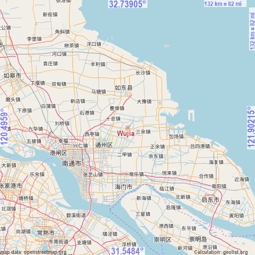
Wujia GPS coordinates[2]
32° 8' 44.412" North, 121° 11' 56.472" East
| Map corner | latitude | longitude |
|---|---|---|
| Upper-left | 32.73905°, | 120.4959° |
| Center: | 32.14567°, | 121.19902° |
| Lower-right: | 31.5484°, | 121.90215° |
| Map W x H: | 132.4×132.4 km | = 82.3×82.3mi |
| max Lat: | 53.31946° ⇑37.9% North |
| Wujia: | 32.14567° |
| min Lat: | ⇓62.1% South 18.22056° |
| min Long | Wujia | max Long |
| 75.07348° | 121.19902° | 134.28917° |
| W 88.6%⇐ | ⇒11.4% E |
Elevation
Elevation of Wujia is 5 m = 16 ft, and this is 479.8 m = 1574 ft below average elevation for this country.
| Max E: |
5622 m = 18445 ft | 97.2% |
| Avg. | 484.8 m = 1591 ft | |
| Wujia | 5 m = 16 ft | |
Min E: |
-3 m = -10 ft | 2.8% |
See also: China elevation on elevation.city.
Geographical zone
Wujia is located in North temperate zone (between Tropic of Cancer and the Arctic Circle). Distance of this Northern Tropic circle is 968.3 km =601.7 mi to South.| Distance of | km | miles | from Wujia |
|---|---|---|---|
| North Pole | 6432.8 | 3997.2 | to North |
| Arctic Circle | 3826.9 | 2377.9 | to North |
| Tropic Cancer | 968.3 | 601.7 | to South |
| Equator | 3574.3 | 2221 | to South |


Nearby cities:
15 places around Wujia: (largest is in red/bold)
• Antou
14.5 km =9 mi,  130°
130°
• Bingfang
16.5 km =10.3 mi,  33°
33°
• Caobu
15.5 km =9.6 mi,  317°
317°
• Dongshe
5.7 km =3.5 mi,  197°
197°
• Erjia
13.7 km =8.5 mi,  185°
185°
• Haifeng
17.4 km =10.8 mi,  82°
82°
• Huolong
12 km =7.5 mi,  145°
145°
• Jinsha
13.3 km =8.3 mi,  242°
242°
• Juegang
19.1 km =11.9 mi,  356°
356°
• Qi’an
14.6 km =9.1 mi,  284°
284°
• Sanyu
8.5 km =5.3 mi,  102°
102°
• Shizong
9 km =5.6 mi,  305°
305°
• Sijia
16.3 km =10.1 mi, 153°
• Xiting
18.6 km =11.6 mi,  260°
260°
• Zhengyu
17.8 km =11.1 mi,  120°
120°
Sources, notices
• [Note1] Compared only with cities in China existing in our database
• [Src1] Map data: © OpenStreetMap contributors (CC-BY-SA)
• [Src2] Other city data from geonames.org with taken over terms of usage.
• [Src3] Geographical zone / Annual Mean Temperature by Robert A. Rohde @ Wikipedia
