Baijian geodata
Baijian (Tianjin) is a populated place; located in China in Asia/Shanghai (GMT+8) time zone. With population of 1,510 people, there are 1085 cities with bigger population in this country. Compared to other cities in China, 86.4% of cities are located further ↓South; 67.2% of cities are located further ←West and 77.7% of cities have higher elevation than Baijian. Note1


Baijian GPS coordinates[2]
39° 59' 39.012" North, 117° 12' 30.996" East
| Map corner | latitude | longitude |
|---|---|---|
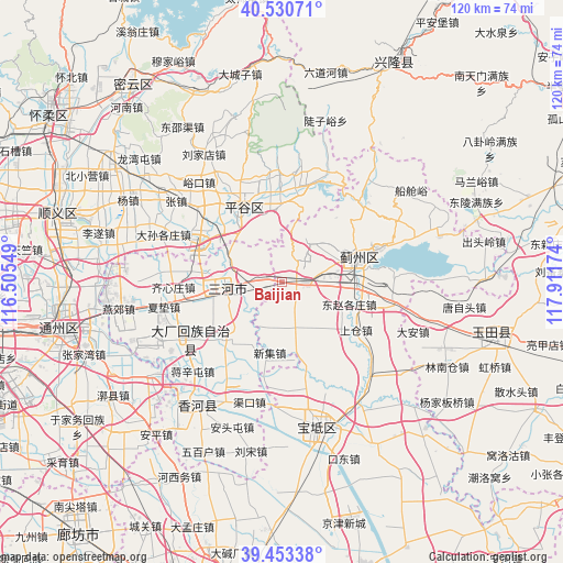
| Upper-left | 40.53071°, | 116.50549° |
| Center: | 39.99417°, | 117.20861° |
| Lower-right: | 39.45338°, | 117.91174° |
| Map W x H: | 119.8×119.8 km | = 74.4×74.4mi |
| max Lat: | 53.31946° ⇑13.6% North |
| Baijian: | 39.99417° |
| min Lat: | ⇓86.4% South 18.22056° |
| min Long | Baijian | max Long |
| 75.07348° | 117.20861° | 134.28917° |
| W 67.2%⇐ | ⇒32.8% E |
Elevation
Elevation of Baijian is 31 m = 102 ft, and this is 453.8 m = 1489 ft below average elevation for this country.
| Max E: |
5622 m = 18445 ft | 77.7% |
| Avg. | 484.8 m = 1591 ft | |
| Baijian | 31 m = 102 ft | |
Min E: |
-3 m = -10 ft | 22.3% |
See also: China elevation on elevation.city.
Geographical zone
Baijian is located in North temperate zone (between Tropic of Cancer and the Arctic Circle). Distance of this Northern Tropic circle is 1841 km =1143.9 mi to South.| Distance of | km | miles | from Baijian |
|---|---|---|---|
| North Pole | 5560.1 | 3454.9 | to North |
| Arctic Circle | 2954.2 | 1835.7 | to North |
| Tropic Cancer | 1841 | 1143.9 | to South |
| Equator | 4446.9 | 2763.2 | to South |


Nearby cities:
15 places around Baijian: (largest is in red/bold)
• Bangjun
4.6 km =2.9 mi,  94°
94°
• Binhe
17.7 km =11 mi,  331°
331°
• Donggaocun
15 km =9.3 mi, 326°
• Dongshigu
16.5 km =10.3 mi,  141°
141°
• Dongtazhuang
15.6 km =9.7 mi, 135°
• Dongzhaogezhuang
14.6 km =9.1 mi,  110°
110°
• Dong’erying
7.3 km =4.5 mi,  124°
124°
• Liujiading
3.8 km =2.4 mi,  203°
203°
• Liuzikou
18.1 km =11.2 mi, 139°
• Lizhuangzi
8.7 km =5.4 mi,  99°
99°
• Sangzi
10.8 km =6.7 mi, 203°
• Shangcang
18.6 km =11.6 mi, 124°
• Touying
3.5 km =2.2 mi,  166°
166°
• Yinliu
16 km =9.9 mi, 94°
• Youguzhuang
10.3 km =6.4 mi,  161°
161°
Sources, notices
• [Note1] Compared only with cities in China existing in our database
• [Src1] Map data: © OpenStreetMap contributors (CC-BY-SA)
• [Src2] Other city data from geonames.org with taken over terms of usage.
• [Src3] Geographical zone / Annual Mean Temperature by Robert A. Rohde @ Wikipedia
