Lingtou geodata
Lingtou (Zhejiang) is a seat of a fourth-order administrative division; located in China in Asia/Shanghai (GMT+8) time zone. In our database, there are 1268 cities with bigger population. Compared to other cities in China, 70.2% of cities are located further ↑North; 87.4% of cities are located further ←West and 70.6% of cities have lower elevation than Lingtou. Note1


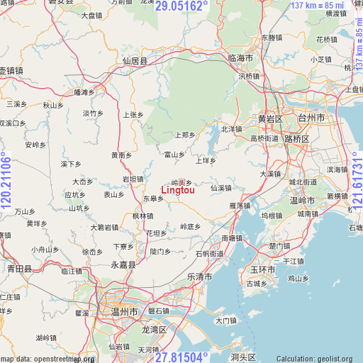
Lingtou GPS coordinates[2]
28° 26' 6.504" North, 120° 54' 51.048" East
| Map corner | latitude | longitude |
|---|---|---|
| Upper-left | 29.05162°, | 120.21106° |
| Center: | 28.43514°, | 120.91418° |
| Lower-right: | 27.81504°, | 121.61731° |
| Map W x H: | 137.5×137.5 km | = 85.4×85.4mi |
| max Lat: | 53.31946° ⇑70.2% North |
| Lingtou: | 28.43514° |
| min Lat: | ⇓29.8% South 18.22056° |
| min Long | Lingtou | max Long |
| 75.07348° | 120.91418° | 134.28917° |
| W 87.4%⇐ | ⇒12.6% E |
Elevation
Elevation of Lingtou is 423 m = 1388 ft, and this is 61.8 m = 203 ft below average elevation for this country.
| Max E: |
5622 m = 18445 ft | 29.4% |
| Avg. | 484.8 m = 1591 ft | |
| Lingtou | 423 m = 1388 ft | |
Min E: |
-3 m = -10 ft | 70.6% |
See also: China elevation on elevation.city.
Geographical zone
Lingtou is located in North temperate zone (between Tropic of Cancer and the Arctic Circle). Distance of this Northern Tropic circle is 555.8 km =345.4 mi to South.| Distance of | km | miles | from Lingtou |
|---|---|---|---|
| North Pole | 6845.4 | 4253.5 | to North |
| Arctic Circle | 4239.5 | 2634.3 | to North |
| Tropic Cancer | 555.8 | 345.4 | to South |
| Equator | 3161.7 | 1964.6 | to South |


Nearby cities:
15 places around Lingtou: (largest is in red/bold)
• Donggao
12.3 km =7.6 mi,  240°
240°
• Fushan
11.1 km =6.9 mi,  345°
345°
• Fuxi
10.7 km =6.6 mi,  72°
72°
• Hesheng
10.2 km =6.3 mi,  229°
229°
• Lingdi
16.9 km =10.5 mi,  168°
168°
• Lixi
14.1 km =8.8 mi,  258°
258°
• Longxi
13.4 km =8.3 mi,  109°
109°
• Ningxi
18 km =11.2 mi,  17°
17°
• Shangyang
12.7 km =7.9 mi,  42°
42°
• Shangzheng
18.2 km =11.3 mi,  3°
3°
• Xianxi
15 km =9.3 mi,  97°
97°
• Xiyuan
7.7 km =4.8 mi,  253°
253°
• Yanhu
16.4 km =10.2 mi,  147°
147°
• Yantan
18.6 km =11.6 mi,  274°
274°
• Zhangxi
14.5 km =9 mi,  291°
291°
Sources, notices
• [Note1] Compared only with cities in China existing in our database
• [Src1] Map data: © OpenStreetMap contributors (CC-BY-SA)
• [Src2] Other city data from geonames.org with taken over terms of usage.
• [Src3] Geographical zone / Annual Mean Temperature by Robert A. Rohde @ Wikipedia
