Xiangyang geodata
Xiangyang (Zhejiang) is a seat of a fourth-order administrative division; located in China in Asia/Shanghai (GMT+8) time zone. In our database, there are 1268 cities with bigger population. Compared to other cities in China, 73.8% of cities are located further ↑North; 87.5% of cities are located further ←West and 91.2% of cities have higher elevation than Xiangyang. Note1


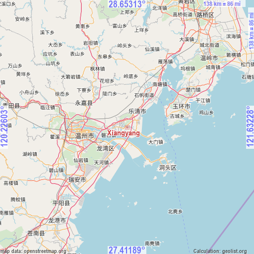
Xiangyang GPS coordinates[2]
28° 2' 3.48" North, 120° 55' 44.94" East
| Map corner | latitude | longitude |
|---|---|---|
| Upper-left | 28.65313°, | 120.22603° |
| Center: | 28.0343°, | 120.92915° |
| Lower-right: | 27.41189°, | 121.63228° |
| Map W x H: | 138×138 km | = 85.7×85.7mi |
| max Lat: | 53.31946° ⇑73.8% North |
| Xiangyang: | 28.0343° |
| min Lat: | ⇓26.2% South 18.22056° |
| min Long | Xiangyang | max Long |
| 75.07348° | 120.92915° | 134.28917° |
| W 87.5%⇐ | ⇒12.5% E |
Elevation
Elevation of Xiangyang is 9 m = 30 ft, and this is 475.8 m = 1561 ft below average elevation for this country.
| Max E: |
5622 m = 18445 ft | 91.2% |
| Avg. | 484.8 m = 1591 ft | |
| Xiangyang | 9 m = 30 ft | |
Min E: |
-3 m = -10 ft | 8.8% |
See also: China elevation on elevation.city.
Geographical zone
Xiangyang is located in North temperate zone (between Tropic of Cancer and the Arctic Circle). Distance of this Northern Tropic circle is 511.2 km =317.6 mi to South.| Distance of | km | miles | from Xiangyang |
|---|---|---|---|
| North Pole | 6889.9 | 4281.2 | to North |
| Arctic Circle | 4284.1 | 2662 | to North |
| Tropic Cancer | 511.2 | 317.6 | to South |
| Equator | 3117.1 | 1936.9 | to South |


Nearby cities:
15 places around Xiangyang: (largest is in red/bold)
• Baishi
9.9 km =6.2 mi,  316°
316°
• Chengbei
14.6 km =9.1 mi,  351°
351°
• Danxi
22.8 km =14.2 mi,  15°
15°
• Doumen
20.8 km =12.9 mi,  332°
332°
• Hongqiao
23 km =14.3 mi,  25°
25°
• Liushi
3.5 km =2.2 mi,  301°
301°
• Nanyue
22.4 km =13.9 mi,  41°
41°
• Puqi
19 km =11.8 mi, 39°
• Qidu
16.5 km =10.3 mi,  259°
259°
• Shatou
24.9 km =15.5 mi, 317°
• Shifan
19.9 km =12.4 mi, 27°
• Sidu
20.4 km =12.7 mi,  6°
6°
• Tiancheng
18.2 km =11.3 mi, 33°
• Wengyang
3.7 km =2.3 mi,  99°
99°
• Wuniu
13.5 km =8.4 mi,  272°
272°
Sources, notices
• [Note1] Compared only with cities in China existing in our database
• [Src1] Map data: © OpenStreetMap contributors (CC-BY-SA)
• [Src2] Other city data from geonames.org with taken over terms of usage.
• [Src3] Geographical zone / Annual Mean Temperature by Robert A. Rohde @ Wikipedia
