Jiangyou geodata
Jiangyou (Sichuan) is a populated place; located in China in Asia/Shanghai (GMT+8) time zone. With population of 127,225 people, there are 344 cities with bigger population in this country. Compared to other cities in China, 59.9% of cities are located further ↓South; 89.4% of cities are located further →East and 75.2% of cities have lower elevation than Jiangyou. Note1


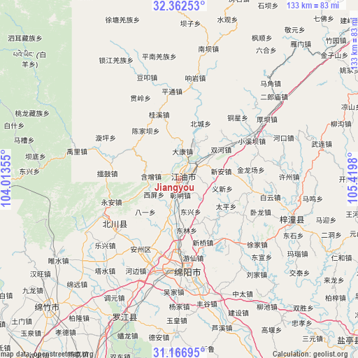
Jiangyou GPS coordinates[2]
31° 46' 0.012" North, 104° 43' 0.012" East
| Map corner | latitude | longitude |
|---|---|---|
| Upper-left | 32.36253°, | 104.01355° |
| Center: | 31.76667°, | 104.71667° |
| Lower-right: | 31.16695°, | 105.4198° |
| Map W x H: | 132.9×132.9 km | = 82.6×82.6mi |
| max Lat: | 53.31946° ⇑40.1% North |
| Jiangyou: | 31.76667° |
| min Lat: | ⇓59.9% South 18.22056° |
| min Long | Jiangyou | max Long |
| 75.07348° | 104.71667° | 134.28917° |
| W 10.6%⇐ | ⇒89.4% E |
Elevation
Elevation of Jiangyou is 527 m = 1729 ft, and this is 42.2 m = 138 ft above average elevation for this country.
| Max E: |
5622 m = 18445 ft | 24.8% |
| Jiangyou | 527 m 1729 ft | |
| Avg. | 484.8 m = 1591 ft | |
Min E: |
-3 m = -10 ft | 75.2% |
See also: Jiangyou elevation on elevation.city.
Geographical zone
Jiangyou is located in North temperate zone (between Tropic of Cancer and the Arctic Circle). Distance of this Northern Tropic circle is 926.2 km =575.5 mi to South.| Distance of | km | miles | from Jiangyou |
|---|---|---|---|
| North Pole | 6474.9 | 4023.3 | to North |
| Arctic Circle | 3869.1 | 2404.1 | to North |
| Tropic Cancer | 926.2 | 575.5 | to South |
| Equator | 3532.1 | 2194.7 | to South |


Nearby cities:
15 places around Jiangyou: (largest is in red/bold)
• Deyang
77.6 km =48.2 mi,  204°
204°
• Fengyi
82.1 km =51 mi,  263°
263°
• Huagai
28.9 km =18 mi,  211°
211°
• Jiannan
68.2 km =42.4 mi,  226°
226°
• Kaijiang
80.9 km =50.3 mi,  182°
182°
• Long’an
73.6 km =45.7 mi,  346°
346°
• Luojiang
55.1 km =34.2 mi, 201°
• Magong
69.1 km =42.9 mi,  25°
25°
• Mianyang
33.4 km =20.8 mi,  185°
185°
• Pu’an
76.9 km =47.8 mi,  66°
66°
• Qifo
80.2 km =49.8 mi,  41°
41°
• Suhe
78 km =48.5 mi, 33°
• Wenchang
43.9 km =27.3 mi,  109°
109°
• Yongchang
28.7 km =17.8 mi,  246°
246°
• Zhongba
2.5 km =1.6 mi,  59°
59°
Sources, notices
• [Note1] Compared only with cities in China existing in our database
• [Src1] Map data: © OpenStreetMap contributors (CC-BY-SA)
• [Src2] Other city data from geonames.org with taken over terms of usage.
• [Src3] Geographical zone / Annual Mean Temperature by Robert A. Rohde @ Wikipedia
