Jinlong geodata
Jinlong (Chongqing) is a seat of a fourth-order administrative division; located in China in Asia/Shanghai (GMT+8) time zone. In our database, there are 1268 cities with bigger population. Compared to other cities in China, 59.6% of cities are located further ↑North; 86.7% of cities are located further →East and 62.5% of cities have lower elevation than Jinlong. Note1


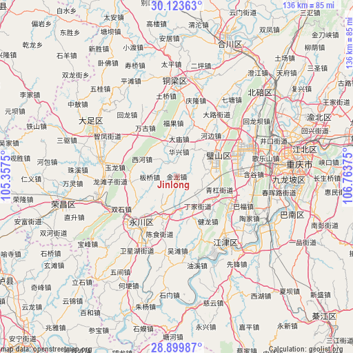
Jinlong GPS coordinates[2]
29° 30' 48.96" North, 106° 3' 38.232" East
| Map corner | latitude | longitude |
|---|---|---|
| Upper-left | 30.12363°, | 105.3575° |
| Center: | 29.5136°, | 106.06062° |
| Lower-right: | 28.89987°, | 106.76375° |
| Map W x H: | 136.1×136.1 km | = 84.6×84.6mi |
| max Lat: | 53.31946° ⇑59.6% North |
| Jinlong: | 29.5136° |
| min Lat: | ⇓40.4% South 18.22056° |
| min Long | Jinlong | max Long |
| 75.07348° | 106.06062° | 134.28917° |
| W 13.3%⇐ | ⇒86.7% E |
Elevation
Elevation of Jinlong is 290 m = 951 ft, and this is 194.8 m = 639 ft below average elevation for this country.
| Max E: |
5622 m = 18445 ft | 37.5% |
| Avg. | 484.8 m = 1591 ft | |
| Jinlong | 290 m = 951 ft | |
Min E: |
-3 m = -10 ft | 62.5% |
See also: China elevation on elevation.city.
Geographical zone
Jinlong is located in North temperate zone (between Tropic of Cancer and the Arctic Circle). Distance of this Northern Tropic circle is 675.7 km =419.9 mi to South.| Distance of | km | miles | from Jinlong |
|---|---|---|---|
| North Pole | 6725.5 | 4179 | to North |
| Arctic Circle | 4119.6 | 2559.8 | to North |
| Tropic Cancer | 675.7 | 419.9 | to South |
| Equator | 3281.6 | 2039.1 | to South |


Nearby cities:
15 places around Jinlong: (largest is in red/bold)
• Anxi
5.9 km =3.7 mi,  342°
342°
• Banqiao
10.4 km =6.5 mi,  269°
269°
• Bicheng
18.3 km =11.4 mi,  60°
60°
• Damiao
14.6 km =9.1 mi,  3°
3°
• Daxing
10.7 km =6.6 mi, 63°
• Da’an
15.2 km =9.4 mi,  197°
197°
• Dingjia
14.1 km =8.8 mi,  145°
145°
• Fulu
12.7 km =7.9 mi,  34°
34°
• Huaxing
9.6 km =6 mi,  5°
5°
• Qinggang
17.7 km =11 mi,  106°
106°
• Sanhe
18.8 km =11.7 mi,  168°
168°
• Weilong
13.3 km =8.3 mi, 336°
• Xihe
14.9 km =9.3 mi,  296°
296°
• Yongjia
8.7 km =5.4 mi,  318°
318°
• Zhengxing
9.1 km =5.7 mi,  133°
133°
Sources, notices
• [Note1] Compared only with cities in China existing in our database
• [Src1] Map data: © OpenStreetMap contributors (CC-BY-SA)
• [Src2] Other city data from geonames.org with taken over terms of usage.
• [Src3] Geographical zone / Annual Mean Temperature by Robert A. Rohde @ Wikipedia
