Zhengxing geodata
Zhengxing (Chongqing) is a seat of a fourth-order administrative division; located in China in Asia/Shanghai (GMT+8) time zone. In our database, there are 1268 cities with bigger population. Compared to other cities in China, 60.2% of cities are located further ↑North; 86.4% of cities are located further →East and 67.1% of cities have lower elevation than Zhengxing. Note1


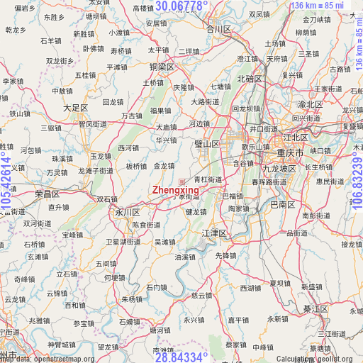
Zhengxing GPS coordinates[2]
29° 27' 26.676" North, 106° 7' 45.336" East
| Map corner | latitude | longitude |
|---|---|---|
| Upper-left | 30.06778°, | 105.42614° |
| Center: | 29.45741°, | 106.12926° |
| Lower-right: | 28.84334°, | 106.83239° |
| Map W x H: | 136.1×136.1 km | = 84.6×84.6mi |
| max Lat: | 53.31946° ⇑60.2% North |
| Zhengxing: | 29.45741° |
| min Lat: | ⇓39.8% South 18.22056° |
| min Long | Zhengxing | max Long |
| 75.07348° | 106.12926° | 134.28917° |
| W 13.6%⇐ | ⇒86.4% E |
Elevation
Elevation of Zhengxing is 360 m = 1181 ft, and this is 124.8 m = 409 ft below average elevation for this country.
| Max E: |
5622 m = 18445 ft | 32.9% |
| Avg. | 484.8 m = 1591 ft | |
| Zhengxing | 360 m = 1181 ft | |
Min E: |
-3 m = -10 ft | 67.1% |
See also: China elevation on elevation.city.
Geographical zone
Zhengxing is located in North temperate zone (between Tropic of Cancer and the Arctic Circle). Distance of this Northern Tropic circle is 669.4 km =415.9 mi to South.| Distance of | km | miles | from Zhengxing |
|---|---|---|---|
| North Pole | 6731.7 | 4182.9 | to North |
| Arctic Circle | 4125.8 | 2563.7 | to North |
| Tropic Cancer | 669.4 | 415.9 | to South |
| Equator | 3275.4 | 2035.2 | to South |


Nearby cities:
15 places around Zhengxing: (largest is in red/bold)
• Anxi
14.6 km =9.1 mi,  324°
324°
• Bicheng
17.9 km =11.1 mi,  31°
31°
• Daxing
11.4 km =7.1 mi,  15°
15°
• Da’an
13.8 km =8.6 mi,  233°
233°
• Dingjia
5.5 km =3.4 mi,  166°
166°
• Fulu
16.8 km =10.4 mi,  1°
1°
• Guangpu
13.6 km =8.5 mi, 173°
• Huaxing
16.8 km =10.4 mi,  339°
339°
• Jianlong
12.3 km =7.6 mi,  153°
153°
• Jinlong
9.1 km =5.7 mi,  313°
313°
• Qinggang
10.4 km =6.5 mi,  83°
83°
• Sanhe
12.5 km =7.8 mi,  193°
193°
• Shuangfu
14.5 km =9 mi,  109°
109°
• Yongjia
17.8 km =11.1 mi, 315°
• Zouma
16.1 km =10 mi, 84°
Sources, notices
• [Note1] Compared only with cities in China existing in our database
• [Src1] Map data: © OpenStreetMap contributors (CC-BY-SA)
• [Src2] Other city data from geonames.org with taken over terms of usage.
• [Src3] Geographical zone / Annual Mean Temperature by Robert A. Rohde @ Wikipedia
