Songji geodata
Songji (Henan) is a seat of a fourth-order administrative division; located in China in Asia/Shanghai (GMT+8) time zone. In our database, there are 1268 cities with bigger population. Compared to other cities in China, 67.9% of cities are located further ↓South; 51.5% of cities are located further →East and 66.8% of cities have higher elevation than Songji. Note1


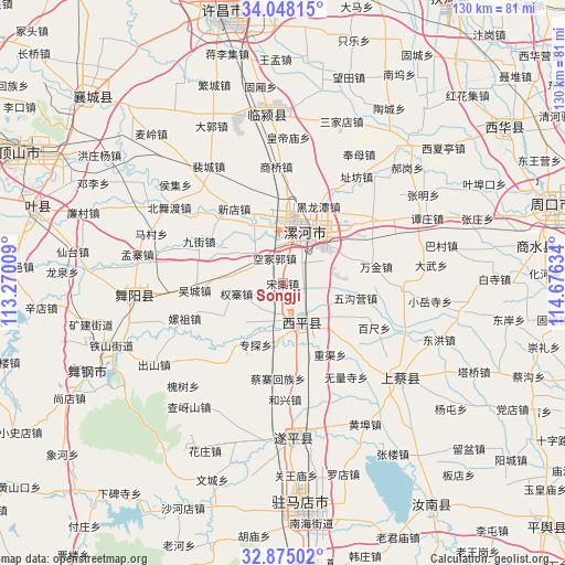
Songji GPS coordinates[2]
33° 27' 48.852" North, 113° 58' 23.556" East
| Map corner | latitude | longitude |
|---|---|---|
| Upper-left | 34.04815°, | 113.27009° |
| Center: | 33.46357°, | 113.97321° |
| Lower-right: | 32.87502°, | 114.67634° |
| Map W x H: | 130.4×130.4 km | = 81×81mi |
| max Lat: | 53.31946° ⇑32.1% North |
| Songji: | 33.46357° |
| min Lat: | ⇓67.9% South 18.22056° |
| min Long | Songji | max Long |
| 75.07348° | 113.97321° | 134.28917° |
| W 48.5%⇐ | ⇒51.5% E |
Elevation
Elevation of Songji is 65 m = 213 ft, and this is 419.8 m = 1377 ft below average elevation for this country.
| Max E: |
5622 m = 18445 ft | 66.8% |
| Avg. | 484.8 m = 1591 ft | |
| Songji | 65 m = 213 ft | |
Min E: |
-3 m = -10 ft | 33.2% |
See also: China elevation on elevation.city.
Geographical zone
Songji is located in North temperate zone (between Tropic of Cancer and the Arctic Circle). Distance of this Northern Tropic circle is 1114.9 km =692.8 mi to South.| Distance of | km | miles | from Songji |
|---|---|---|---|
| North Pole | 6286.3 | 3906.1 | to North |
| Arctic Circle | 3680.4 | 2286.9 | to North |
| Tropic Cancer | 1114.9 | 692.8 | to South |
| Equator | 3720.8 | 2312 | to South |


Nearby cities:
15 places around Songji: (largest is in red/bold)
• Baicheng
9.4 km =5.8 mi,  155°
155°
• Daliu
7.9 km =4.9 mi,  304°
304°
• Dizhuang
14.3 km =8.9 mi,  38°
38°
• Ganhechen
11.4 km =7.1 mi,  22°
22°
• Lianhua
20.6 km =12.8 mi,  316°
316°
• Longcheng
16.8 km =10.4 mi,  341°
341°
• Luohe
12.9 km =8 mi,  30°
30°
• Quanzhai
10.9 km =6.8 mi,  257°
257°
• Shiling
16.1 km =10 mi,  242°
242°
• Tandian
10.7 km =6.6 mi,  204°
204°
• Wucheng
20.4 km =12.7 mi,  265°
265°
• Xindian
20.6 km =12.8 mi,  326°
326°
• Yancheng Chengguanzhen
13.5 km =8.4 mi,  5°
5°
• Yangzhuang
18.9 km =11.7 mi,  221°
221°
• Zhuantan
15.5 km =9.6 mi, 204°
Sources, notices
• [Note1] Compared only with cities in China existing in our database
• [Src1] Map data: © OpenStreetMap contributors (CC-BY-SA)
• [Src2] Other city data from geonames.org with taken over terms of usage.
• [Src3] Geographical zone / Annual Mean Temperature by Robert A. Rohde @ Wikipedia
