Mazhuang geodata
Mazhuang (Henan) is a seat of a fourth-order administrative division; located in China in Asia/Shanghai (GMT+8) time zone. In our database, there are 1268 cities with bigger population. Compared to other cities in China, 68.3% of cities are located further ↓South; 55.3% of cities are located further →East and 61.7% of cities have higher elevation than Mazhuang. Note1


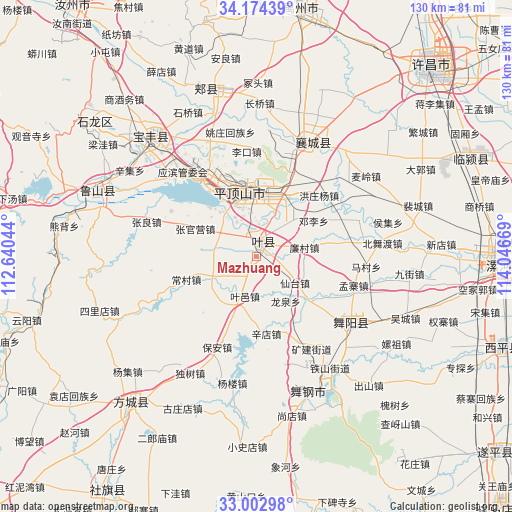
Mazhuang GPS coordinates[2]
33° 35' 26.412" North, 113° 20' 36.816" East
| Map corner | latitude | longitude |
|---|---|---|
| Upper-left | 34.17439°, | 112.64044° |
| Center: | 33.59067°, | 113.34356° |
| Lower-right: | 33.00298°, | 114.04669° |
| Map W x H: | 130.2×130.2 km | = 80.9×80.9mi |
| max Lat: | 53.31946° ⇑31.7% North |
| Mazhuang: | 33.59067° |
| min Lat: | ⇓68.3% South 18.22056° |
| min Long | Mazhuang | max Long |
| 75.07348° | 113.34356° | 134.28917° |
| W 44.7%⇐ | ⇒55.3% E |
Elevation
Elevation of Mazhuang is 89 m = 292 ft, and this is 395.8 m = 1299 ft below average elevation for this country.
| Max E: |
5622 m = 18445 ft | 61.7% |
| Avg. | 484.8 m = 1591 ft | |
| Mazhuang | 89 m = 292 ft | |
Min E: |
-3 m = -10 ft | 38.3% |
See also: China elevation on elevation.city.
Geographical zone
Mazhuang is located in North temperate zone (between Tropic of Cancer and the Arctic Circle). Distance of this Northern Tropic circle is 1129 km =701.5 mi to South.| Distance of | km | miles | from Mazhuang |
|---|---|---|---|
| North Pole | 6272.1 | 3897.3 | to North |
| Arctic Circle | 3666.2 | 2278.1 | to North |
| Tropic Cancer | 1129 | 701.5 | to South |
| Equator | 3734.9 | 2320.8 | to South |


Nearby cities:
15 places around Mazhuang: (largest is in red/bold)
• Beidu
14 km =8.7 mi,  338°
338°
• Caozhen
17.4 km =10.8 mi,  316°
316°
• Dengli
17.3 km =10.7 mi,  58°
58°
• Gongdian
11.7 km =7.3 mi,  46°
46°
• Jiuxian
11.3 km =7 mi,  201°
201°
• Kunyang
3.3 km =2.1 mi,  2°
2°
• Liancun
12.3 km =7.6 mi,  79°
79°
• Longquan
13.7 km =8.5 mi,  146°
146°
• Pingdingshan
16.9 km =10.5 mi,  346°
346°
• Rendian
11.5 km =7.1 mi,  290°
290°
• Tianzhuang
2.7 km =1.7 mi,  159°
159°
• Xiali
13.8 km =8.6 mi,  241°
241°
• Xiantai
12 km =7.5 mi,  124°
124°
• Zhangguanying
17.2 km =10.7 mi, 294°
• Zunhuadian
13.9 km =8.6 mi,  22°
22°
Sources, notices
• [Note1] Compared only with cities in China existing in our database
• [Src1] Map data: © OpenStreetMap contributors (CC-BY-SA)
• [Src2] Other city data from geonames.org with taken over terms of usage.
• [Src3] Geographical zone / Annual Mean Temperature by Robert A. Rohde @ Wikipedia
