Huangtong geodata
Huangtong (Hainan) is a seat of a fourth-order administrative division; located in China in Asia/Shanghai (GMT+8) time zone. In our database, there are 1268 cities with bigger population. Compared to other cities in China, 98.9% of cities are located further ↑North; 72.1% of cities are located further →East and 63.1% of cities have higher elevation than Huangtong. Note1


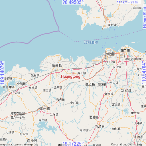
Huangtong GPS coordinates[2]
19° 50' 6.108" North, 109° 50' 38.076" East
| Map corner | latitude | longitude |
|---|---|---|
| Upper-left | 20.49505°, | 109.14079° |
| Center: | 19.83503°, | 109.84391° |
| Lower-right: | 19.17225°, | 110.54704° |
| Map W x H: | 147.1×147.1 km | = 91.4×91.4mi |
| max Lat: | 53.31946° ⇑98.9% North |
| Huangtong: | 19.83503° |
| min Lat: | ⇓1.1% South 18.22056° |
| min Long | Huangtong | max Long |
| 75.07348° | 109.84391° | 134.28917° |
| W 27.9%⇐ | ⇒72.1% E |
Elevation
Elevation of Huangtong is 82 m = 269 ft, and this is 402.8 m = 1322 ft below average elevation for this country.
| Max E: |
5622 m = 18445 ft | 63.1% |
| Avg. | 484.8 m = 1591 ft | |
| Huangtong | 82 m = 269 ft | |
Min E: |
-3 m = -10 ft | 36.9% |
See also: China elevation on elevation.city.
Geographical zone
Huangtong is located in North Torrid zone (between Equator and Tropic of Cancer). Distance of this Northern Tropic circle is 400.5 km =248.9 mi to North.| Distance of | km | miles | from Huangtong |
|---|---|---|---|
| North Pole | 7801.6 | 4847.7 | to North |
| Arctic Circle | 5195.7 | 3228.5 | to North |
| Tropic Cancer | 400.5 | 248.9 | to North |
| Equator | 2205.4 | 1370.4 | to South |


Nearby cities:
15 places around Huangtong: (largest is in red/bold)
• Bohou
12 km =7.5 mi,  295°
295°
• Bolian
21.4 km =13.3 mi,  280°
280°
• Dongyin
25.2 km =15.7 mi, 303°
• Duowen
10.5 km =6.5 mi,  231°
231°
• Fushan
8.6 km =5.3 mi,  89°
89°
• Heshe
29.4 km =18.3 mi,  206°
206°
• Jialai
21 km =13 mi, 227°
• Jinjiang
20.9 km =13 mi,  124°
124°
• Laocheng
32.2 km =20 mi,  63°
63°
• Lincheng
18.4 km =11.4 mi, 296°
• Longbo
8.3 km =5.2 mi,  174°
174°
• Nanbao
31 km =19.3 mi,  236°
236°
• Qiaotou
16.8 km =10.4 mi,  30°
30°
• Ruixi
31.4 km =19.5 mi,  110°
110°
• Zhongxing
29.6 km =18.4 mi,  178°
178°
Sources, notices
• [Note1] Compared only with cities in China existing in our database
• [Src1] Map data: © OpenStreetMap contributors (CC-BY-SA)
• [Src2] Other city data from geonames.org with taken over terms of usage.
• [Src3] Geographical zone / Annual Mean Temperature by Robert A. Rohde @ Wikipedia
