Qiaotou geodata
Qiaotou (Hainan) is a seat of a fourth-order administrative division; located in China in Asia/Shanghai (GMT+8) time zone. In our database, there are 1268 cities with bigger population. Compared to other cities in China, 98.8% of cities are located further ↑North; 71.6% of cities are located further →East and 77.2% of cities have higher elevation than Qiaotou. Note1


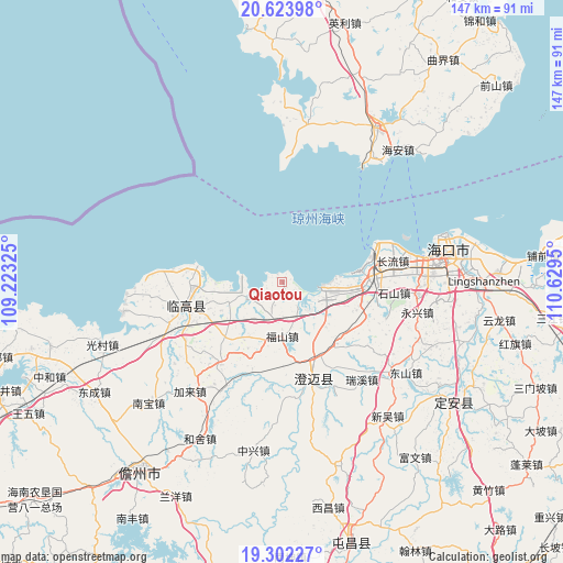
Qiaotou GPS coordinates[2]
19° 57' 52.236" North, 109° 55' 34.932" East
| Map corner | latitude | longitude |
|---|---|---|
| Upper-left | 20.62398°, | 109.22325° |
| Center: | 19.96451°, | 109.92637° |
| Lower-right: | 19.30227°, | 110.6295° |
| Map W x H: | 147×147 km | = 91.3×91.3mi |
| max Lat: | 53.31946° ⇑98.8% North |
| Qiaotou: | 19.96451° |
| min Lat: | ⇓1.2% South 18.22056° |
| min Long | Qiaotou | max Long |
| 75.07348° | 109.92637° | 134.28917° |
| W 28.4%⇐ | ⇒71.6% E |
Elevation
Elevation of Qiaotou is 32 m = 105 ft, and this is 452.8 m = 1486 ft below average elevation for this country.
| Max E: |
5622 m = 18445 ft | 77.2% |
| Avg. | 484.8 m = 1591 ft | |
| Qiaotou | 32 m = 105 ft | |
Min E: |
-3 m = -10 ft | 22.8% |
See also: China elevation on elevation.city.
Geographical zone
Qiaotou is located in North Torrid zone (between Equator and Tropic of Cancer). Distance of this Northern Tropic circle is 386.1 km =239.9 mi to North.| Distance of | km | miles | from Qiaotou |
|---|---|---|---|
| North Pole | 7787.2 | 4838.7 | to North |
| Arctic Circle | 5181.3 | 3219.5 | to North |
| Tropic Cancer | 386.1 | 239.9 | to North |
| Equator | 2219.8 | 1379.3 | to South |


Nearby cities:
15 places around Qiaotou: (largest is in red/bold)
• Bohou
21.5 km =13.4 mi,  244°
244°
• Bolian
31.5 km =19.6 mi,  250°
250°
• Changliu
29.2 km =18.1 mi,  79°
79°
• Dongyin
29.6 km =18.4 mi,  269°
269°
• Duowen
26.8 km =16.7 mi,  218°
218°
• Fushan
14.3 km =8.9 mi,  180°
180°
• Huangtong
16.8 km =10.4 mi,  210°
210°
• Jiaoweixiang
34 km =21.1 mi,  6°
6°
• Jinjiang
27.6 km =17.1 mi,  161°
161°
• Laocheng
20.2 km =12.6 mi,  90°
90°
• Lincheng
25.9 km =16.1 mi,  255°
255°
• Longbo
23.9 km =14.9 mi,  198°
198°
• Mei’an
28.8 km =17.9 mi,  109°
109°
• Ruixi
32.9 km =20.4 mi,  140°
140°
• Shishan
29.2 km =18.1 mi,  96°
96°
Sources, notices
• [Note1] Compared only with cities in China existing in our database
• [Src1] Map data: © OpenStreetMap contributors (CC-BY-SA)
• [Src2] Other city data from geonames.org with taken over terms of usage.
• [Src3] Geographical zone / Annual Mean Temperature by Robert A. Rohde @ Wikipedia
