Biaoxi geodata
Biaoxi (Zhejiang) is a seat of a fourth-order administrative division; located in China in Asia/Shanghai (GMT+8) time zone. In our database, there are 1268 cities with bigger population. Compared to other cities in China, 74.9% of cities are located further ↑North; 78.8% of cities are located further ←West and 67.8% of cities have lower elevation than Biaoxi. Note1


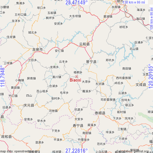
Biaoxi GPS coordinates[2]
27° 51' 5.796" North, 119° 29' 52.512" East
| Map corner | latitude | longitude |
|---|---|---|
| Upper-left | 28.47149°, | 118.7948° |
| Center: | 27.85161°, | 119.49792° |
| Lower-right: | 27.22816°, | 120.20105° |
| Map W x H: | 138.2×138.2 km | = 85.9×85.9mi |
| max Lat: | 53.31946° ⇑74.9% North |
| Biaoxi: | 27.85161° |
| min Lat: | ⇓25.1% South 18.22056° |
| min Long | Biaoxi | max Long |
| 75.07348° | 119.49792° | 134.28917° |
| W 78.8%⇐ | ⇒21.2% E |
Elevation
Elevation of Biaoxi is 373 m = 1224 ft, and this is 111.8 m = 367 ft below average elevation for this country.
| Max E: |
5622 m = 18445 ft | 32.2% |
| Avg. | 484.8 m = 1591 ft | |
| Biaoxi | 373 m = 1224 ft | |
Min E: |
-3 m = -10 ft | 67.8% |
See also: China elevation on elevation.city.
Geographical zone
Biaoxi is located in North temperate zone (between Tropic of Cancer and the Arctic Circle). Distance of this Northern Tropic circle is 490.9 km =305 mi to South.| Distance of | km | miles | from Biaoxi |
|---|---|---|---|
| North Pole | 6910.3 | 4293.9 | to North |
| Arctic Circle | 4304.4 | 2674.6 | to North |
| Tropic Cancer | 490.9 | 305 | to South |
| Equator | 3096.8 | 1924.3 | to South |


Nearby cities:
15 places around Biaoxi: (largest is in red/bold)
• Chengzhao
14.3 km =8.9 mi,  55°
55°
• Dadi
10.3 km =6.4 mi,  201°
201°
• Daji
9.6 km =6 mi,  115°
115°
• Dajun
13 km =8.1 mi,  28°
28°
• Geshan
15.4 km =9.6 mi,  286°
286°
• Hexi
18.9 km =11.7 mi,  43°
43°
• Jiadi
15 km =9.3 mi,  171°
171°
• Jingnan
17.6 km =10.9 mi, 124°
• Luci
9.8 km =6.1 mi, 286°
• Maoyang
18.1 km =11.2 mi,  218°
218°
• Shawan
3.2 km =2 mi,  272°
272°
• Wutong
4.4 km =2.7 mi,  15°
15°
• Yanxi
16.1 km =10 mi,  143°
143°
• Yingchuan
18 km =11.2 mi, 270°
• Yunfeng
18.4 km =11.4 mi,  319°
319°
Sources, notices
• [Note1] Compared only with cities in China existing in our database
• [Src1] Map data: © OpenStreetMap contributors (CC-BY-SA)
• [Src2] Other city data from geonames.org with taken over terms of usage.
• [Src3] Geographical zone / Annual Mean Temperature by Robert A. Rohde @ Wikipedia
